


16
Reference
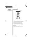
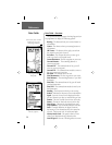
The Map Page
The Map Page - Overview
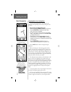
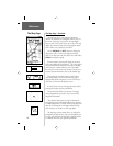
The Map Page shows your present position and
direction of movement, as a triangular ‘Position Icon’, in
the center of the map. As you travel, the map display
leaves a “trail” (track log) of where you’ve been. The map
display also shows the map scale and geographic details
such as lakes, rivers, highways, and towns.
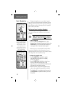
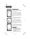
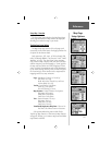
Use the ZOOM IN and OUT buttons to change the
map scale in order to show more map area with less
detail or less map area with more detail. Press and hold to
ZOOM the map scale rapidly.
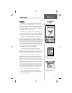
In many instances the map will display an ‘Accuracy
Circle’ surrounding the ‘Position Icon’. The eTrex Legend
uses both map resolution and GPS accuracy in defi ning
your location to a point within the circle. The smaller
the circle, the more accurate your location. For the most
accurate location information, refer to the Satellite Page.
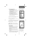
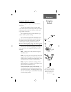
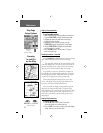
When using the ‘Pan Map’ feature, a small outline
arrow (Map Pointer) can be moved about the page to
highlight and identify map items or to scroll the map to
view areas not shown on the display screen.
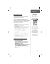
A Status Field at the top of the page provides satellite
tracking and location accuracy information.
Two optional Data fi elds at the bottom of the page
can be programmed to provide a variety of travel and
navigation information.
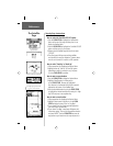
More detailed map features as well as information
about those features can be downloaded to the unit from
a GARMIN MapSource CD-ROM. When using MapSource
data, the word ‘mapsource’ will appear below the map
scale whenever you zoom in to view map details.
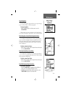
The Map Page Options Menu allows you change the
arrangement of page features, stop active navigation, pan
the map, and customize the map itself to display features
in a manner that meets your personal preferences.
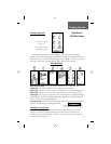
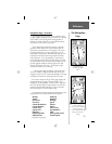
Position Icon
Map Scale
Map Features
Accuracy Circle
Panning Arrow
(Map Pointer)
The Map Page