


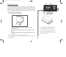
Using G-chart Cartography
Once a G-chart cartridge has been inserted, the map coverage outlines for the
cartridge will automatically appear on-screen. Keep in mind that the display will
not automatically scroll to the map area or zoom to a level where you can see the
coverage outlines. If you do not immediately see the outlines, scroll the cursor to
the broad geographic area covered by the chart and zoom out to another map
scale.
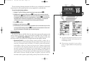
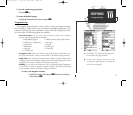
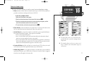
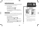
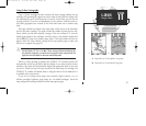
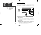
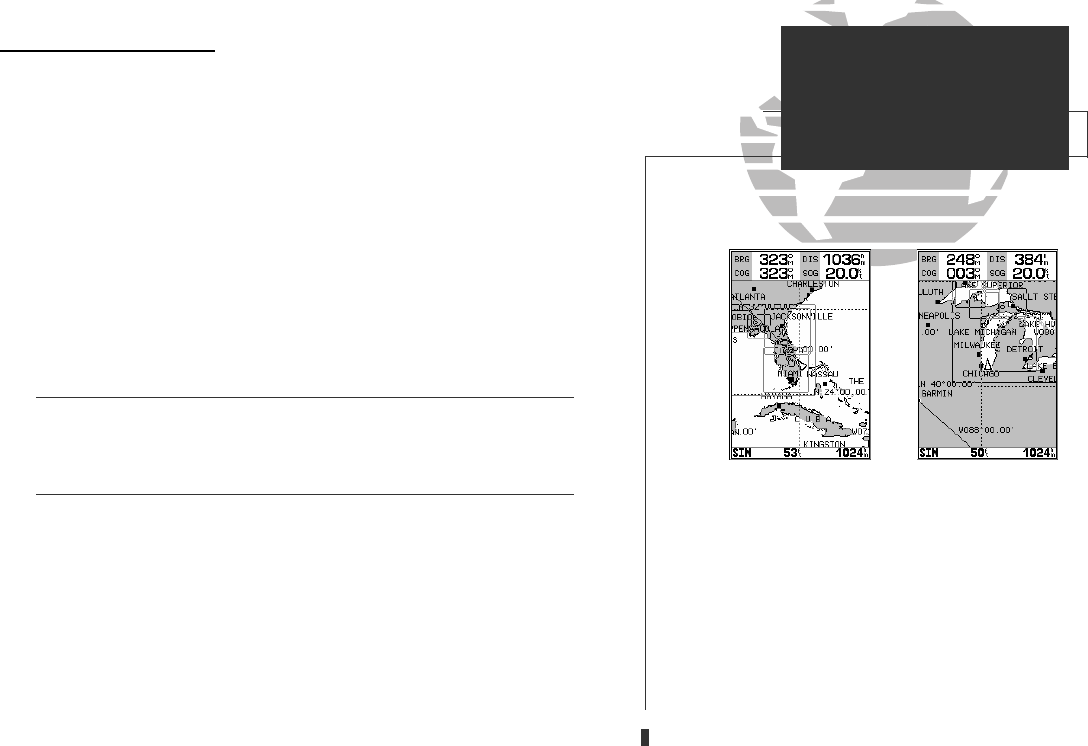
The large outlined box shown is the main chart, which serves as the boundary
area for the entire cartridge. The small outlined box inside the main box are sub-
charts, which provide more detailed coverage of the area indicated. To view the
detailed cartography of any subchart, scroll the cursor to the subchart outline and
use the
Z
key to zoom in to smaller range scales. If the map outlines still do not
appear, check the ‘Map Outlines’ setting on the map options page to make sure
they are set to appear (see page 40).
Whenever you zoom past the usable range of the current electronic chart, the range
field will display ‘Ovr Zm’ or ‘No Map’. These warnings indicate that although you
may still have cartography, you should exercise extreme caution using the data. See
page 39 for more information on Overzoom and No Map modes.
When a G-chart cartridge is installed, the GPSMAP 135 Sounder’s system will
automatically use the best available chart for display. As you enter and exit various
subcharts, the system will automatically display the appropriate chart for the area
you are in. When you leave the area covered by the main map of a cartridge, the
GPSMAP 135 Sounder will default back to using the built-in 64 nm database if it
is available at the current scale.
If you are not seeing certain map items (navaids, depth contours, etc. on
offshore cartridges; highways, boat ramps, etc. on inland cartridges), check the
map configuration settings available from the map options page.
A. Map outlines for G-chart offshore cartography.
B. Map outlines for G-chart inland cartography.
81
AB
SECTION
11
G-CHARTS
Using G-Charts
!
GPS 135 Rev C 8/4/98 4:19 PM Page 81