


AB
The following options are available for the navigation page:
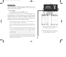
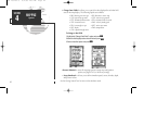
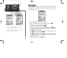
• Change Data Fields?— allows you to define the data displayed in any of the six
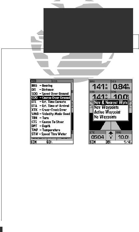
user-selectable data fields. Thirteen data options are available:
• BRG • DIS • DPT
• SOG • COG • STW
• ETE • ETA • TMP
• XTK • VMG • TRN
• CTS
To change a data field:
1. Highlight the ‘Change Data Fields?’ option and press
T
.
2. Highlight the field you want to change and press
T
.
3. Select the desired data field option and press
T
.
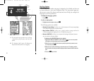
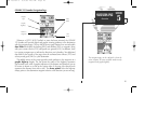
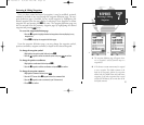
• Configure Highway?— allows you to select what waypoints are shown on the
highway display. Four options are available:
• Nav & Nearest Waypoints— all route and nearest waypoints displayed
• Nav Waypoints— only waypoints in the active route will be displayed
• Active Waypoint— only the active waypoint will be displayed
• No Waypoints— no waypoints will be displayed
To configure the highway display:
1. Highlight the ‘Configure Highway?’ option and press
T
.
2. Select the desired option and press
T
.
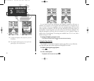
•
Restore Defaults?— resets all navigation page options to the factory settings.
• Setup Simulator?— allows you to define simulator speed, course, altitude, depth,
and position values . See pages 4-19 for more details on using simulator mode.
• Auto COG?— allows you to reset automatic steering while simulating navigation
and cancel any course adjustments made with the
R
keypad.
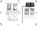
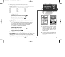
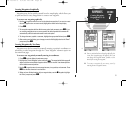
A. Thirteen data options are available for each data
field on the navigation page. The digital
crosstrack error option is especially useful to dis-
play the exact distance you are off course in
feet/miles or meters.
B. To select what waypoints appear on the graphic
highway, highlight the desired setting and press
EDIT/ENTER.
SECTION
5
NAVIGATION PAGE
Options
47
GPS 135 Rev C 8/4/98 4:18 PM Page 47