


Selecting Map Scales
The map display has 16 available range scales from 1/8th to 4096 n.m. (1/4 to
7500km). The map scale is controlled by the
Z
keys, with the current scale dis-
played at the bottom of the data window.
To select a map scale:
1. Press the up Z key to zoom out and the down Z key to zoom in.
The GPSMAP 135 Sounder’s system has a built-in worldwide database to 64
n.m.(see Appendix D for a built-in coverage map), with more detailed coverage
available through the use of G-chart
TM
data cartridges (see pages 80-81 for
installing and using G-chart
TM
cartridges). The GPSMAP 135 Sounder will display
cartography as long as there is chart information available for the range you’ve
selected. Map coverage will conform to the following conditions:
• When the selected zoom range is covered by either the internal database or a
G-chart data cartridge, cartography will be displayed.
• When the selected zoom range is covered by both the internal database and
a G-chart cartridge, cartography will be displayed using the data with the best reso-
lution.
• When the selected zoom range exceeds the resolution of the chart in use by
up to two settings, overzoom cartography will be displayed. The display
will not show any filled landmass areas, and an ‘Ovr Zm’ warning will appear
in the scale field. The lat/lon grid will also be turned on regardless of the map
configuration setting.
• When the selected zoom range exceeds the resolution of the chart in use by more
than two settings, all cartography will be replaced by a track plot display, and a ‘No
Map’ warning will appear in the scale field. The lat/lon grid will be displayed
regardless of the map configuration setting. Additional caution should be used
while navigating in track plot mode.
SECTION
4
MAP PAGE
Selecting Map Scales
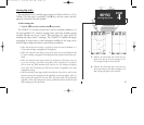
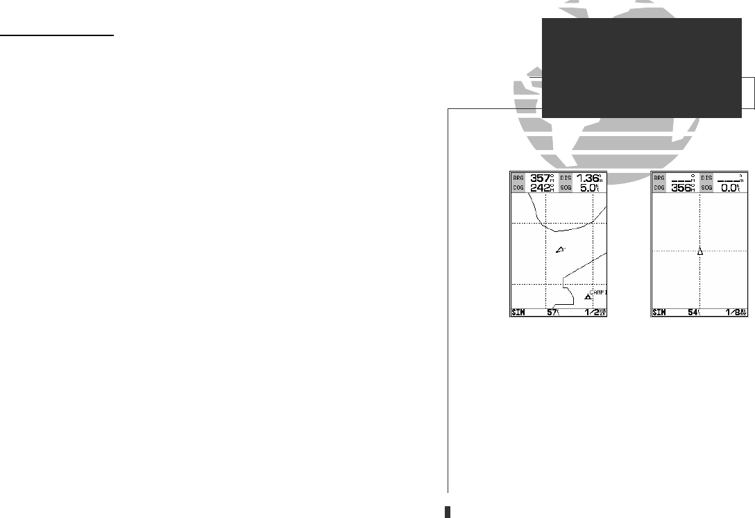
A
B
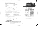
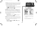
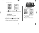
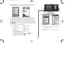
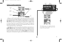
A. Whenever the selected map scale exceeds the reso-
lution of the chart by up to two settings, an ‘Ovr
Zm’ warning will appear in the scale field.
B. Whenever the selected map scale exceeds the reso-
lution of the chart by more than two settings, a ‘No
Map’ warning will appear in the scale field.
39
GPS 135 Rev C 8/4/98 4:18 PM Page 39