


42 GPSMAP 400/500 Series Owner’s Manual
Viewing Information
About AIS
AIS alerts you to area trafc. When connected to an external AIS
device, the chartplotter can show some AIS information about other
vessels that are within range, that are equipped with a transponder,
and that are actively transmitting AIS information. The information
reported for each vessel includes the Maritime Mobile Service
Identity (MMSI), the location, the GPS speed, the GPS heading,
the time that has elapsed since the last position of the vessel was
reported, the nearest approach, and the time to the nearest approach.
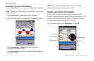
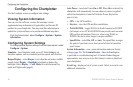
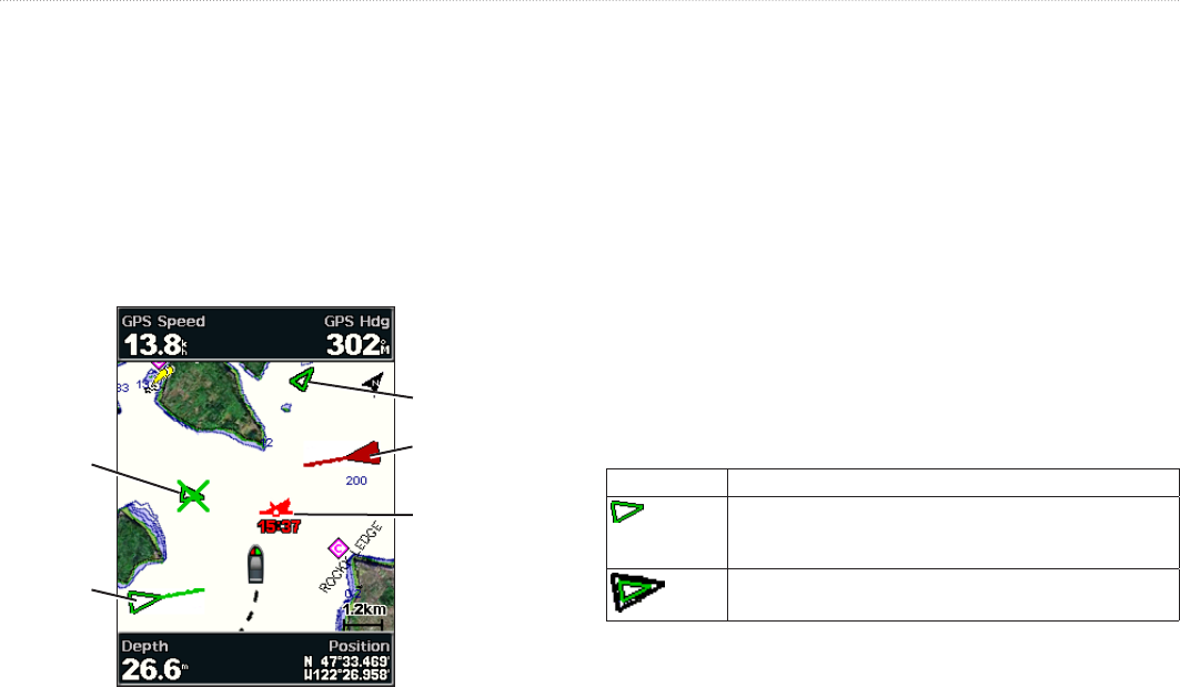
AIS vessel
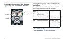
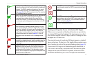
AIS Targeting on the Navigation Chart
Dangerous
AIS target
Lost
AIS target
Closest point and
time of approach to
dangerous target
Tracking
AIS target
About AIS Search and Rescue Transmitters
AIS Search and Rescue Transmitters (AIS-SART, or SART) are
self-contained devices that transmit emergency position reports
when activated. SART transmissions are different than standard AIS
transmissions, so they look different than standard AIS symbols
on the chartplotter. Instead of tracking a SART transmission for
collision avoidance, you track a SART transmission to locate and
assist a vessel.
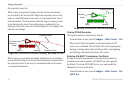
Navigating to a SART Transmission
When you receive a SART transmission, a distress signal alarm
appears.
Select >to begin navigation to the SART
transmission.
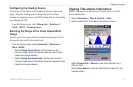
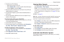
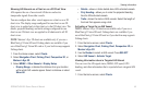
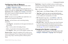
AIS Targeting Symbols
Symbol Description
AIS vessel� The vessel is reporting AIS information� The
direction in which the triangle is pointing indicates the
direction in which the AIS vessel is moving�
Target is selected�