


14 GPSMAP 400/500 Series Owner’s Manual
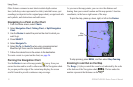
Using Charts
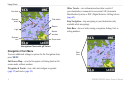
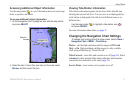
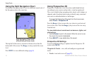
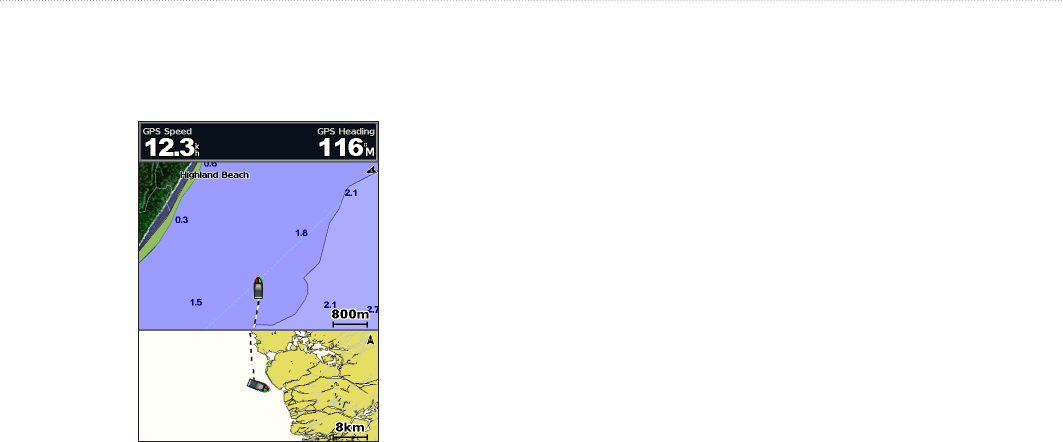
Using the Split Navigation Chart
Use the Split Navigation chart to view two different zoom levels of
the Navigation chart at the same time.
Split Navigation Chart (with
a BlueChart g2 Vision card)
The top half of the screen is zoomed in 10 times closer than the
bottom half of the screen. The keys control the zoom
level.
Press to view additional settings (page 8).
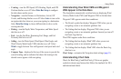
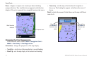
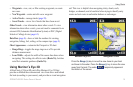
Using Perspective 3D
Perspective 3D provides a view from above and behind the boat
(according to your course), and provides a visual navigation aid.
This view is helpful when navigating tricky shoals, reefs, bridges, or
channels, and is benecial when trying to identify entry routes and
exit routes in unfamiliar harbors or anchorages.
To access the Perspective 3D screen from the Home screen,
select Charts > Perspective 3D�
Press the key to move the view closer to your boat and
lower to the water. Press the key to move the view away
from the boat.
To view details about navaids such as beacons, lights, and
obstructions:
1� Use the Rocker to point to the navaid� When the cursor is over
the navaid, the navaid is highlighted�
2� Press SELECT to view details about the navaid�
Perspective 3D Settings
To access additional settings or options from the Perspective 3D
screen, select
—view, add, and congure waypoints and
tracks.
• —turn tracks on or off (page 28).