


8 GPSMAP 400/500 Series Owner’s Manual
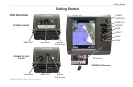
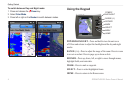
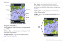
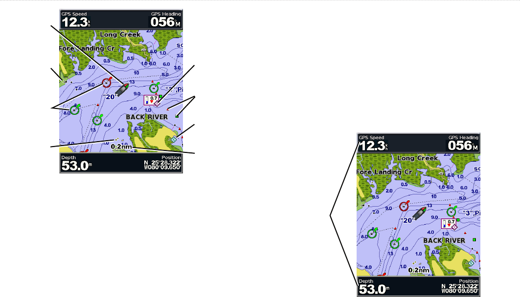
Using Charts
Light
Beacon
Exposed
wreck
Your boat
Marina
services
Exposed
rock
Tide station
Zoom scale
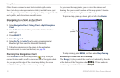
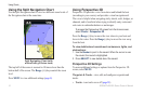
Navigation Chart with g2 Vision
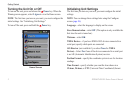
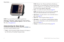
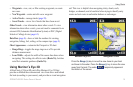
Navigation Chart Menu
To access additional settings or options for the Navigation chart,
press .
—view the Navigation or Fishing chart in full-
screen mode, without numbers.
—view, add, and congure waypoints
(page 25) and tracks (page 28).
—view information about other vessels if
your chartplotter is connected to an external AIS (Automatic
Identication System) or DSC (Digital Selective Calling) device
(page 62).
—stop navigating to your destination (only
available while navigating).
—show or hide cruising, navigation, shing, fuel, or
sailing numbers.
Data
bars