


2. PLOTTER AND PILOT DISPLAY DESCRIPTION
2-14
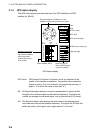
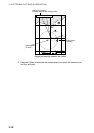
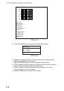
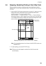
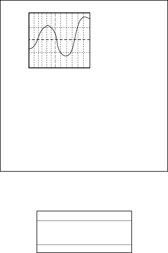
TIME: 12:00
HEIGHT: 2.23 ft
DRAUGHT:3.28 ft
04/11/03 +09
34 38. 913' N
135 26. 051' E
PORT INFORMATION
OSAKA KO
HIGH WATER (MAX)
4.66 ft (17:07)
LOW WATER (MIN)
1.91 ft (10:15)
SUNRISE 06:21L
SUNSET 17:01L
4.66
3.97
3.28
2.60
1.91
0 4 8 12 16 20 24
TIDE window
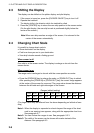
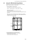
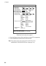
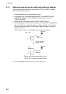
5. Press the [ENTER] knob to show the CHANGE DATE window.
CHANGE DATE
(DD. MM. YYYY.)
04. 11. 2003
LIMIT: 31. 12. 2099
DATE window
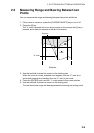
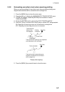
6. Operate the trackball to position the cursor to the digit to change, and then
press the numeric keys to enter a date.
7. Press the [ENTER] knob to show the tidal graph for entered date.
8. Roll the trackball in left-right direction to locate the vertical cursor on the time
desired. Time and height are shown below the graph.
9. Roll the trackball in upward-downward direction to shift the level cursor.
Draught is shown to the left of the graph.
10. Press the [MENU] key to close the TIDE window.