


9. CUSTOMIZING YOUR UNIT
9-7
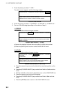
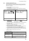
9.1.3 CONTOUR LINES SETUP menu
You can select the color of contour lines, which are lines colored according to
depth. In this paragraph, the operating procedure for setting up contour lines on
NavCharts
TM
is described.
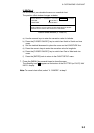
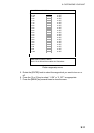
1. Press the [MENU] key to show the main menu.
2. Press the [7] key.
3. If the CHART SETUP menu appears, rotate the [ENTER] knob clockwise to
show the CONTOUR LINES SETUP menu.
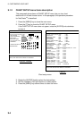
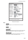
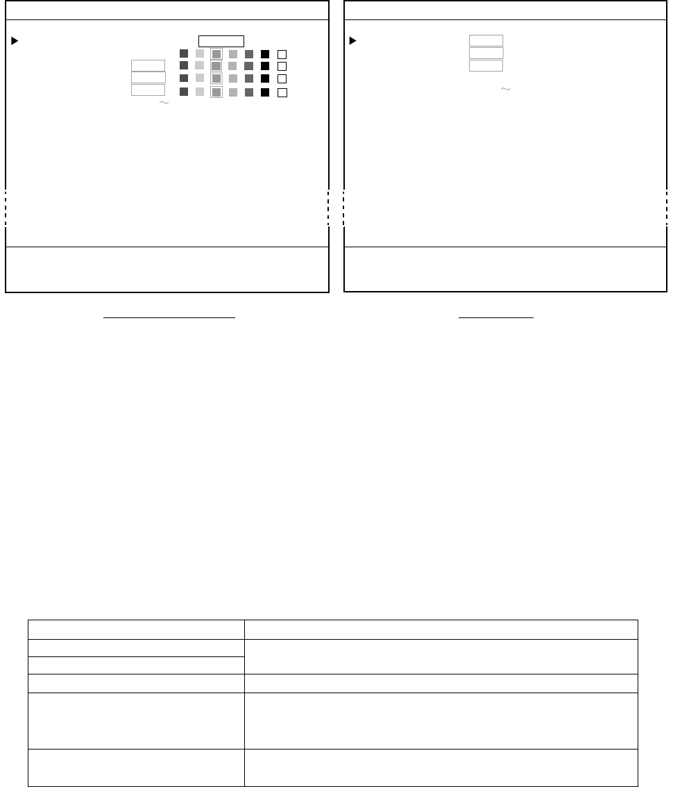
7. CHART SETUP
GOTO CHART DETAILS SETUP
CONTOUR LINES
1. ON 2. OFF
DEPTH < 10 m 0. OFF
DEPTH = 10 m 0. OFF
DEPTH > 10 m 0. OFF
DEPTH INFORMATION 0. OFF
CONTOUR LINES AREA 11100 00328 ft
TURN KNOB TO SELECT MENU.
SELECT THE ITEM OF EACH MENU BY TRACKBALL.
7. CHART SETUP
GOTO CHART DETAILS SETUP
CONTOUR LINES
1. ON 2. OFF
DEPTH 1. ON 2. OFF
BOTTOM TYPE 1. ON 2. OFF
DEPTH SHADE AREA 00020, 00164 ft
CONTOUR LINES AREA
00000 00033 ft
TURN KNOB TO SELECT MENU.
SELECT THE ITEM OF EACH MENU BY TRACKBALL.
NavChart /FURUNO
C-MAP NT
NT
Chart setup menu
4. Rotate the [ENTER] knob to select CONTOUR LINES, and then press the [1]
key to select “1. ON.”
5. Rotate the [ENTER] knob to select DEPTH<10 m, and then press an
appropriate numeric key to select a color.
6. Set the colors for DEPTH=10 m and DEPTH>10 m also.
7. Rotate the [ENTER] knob to select DEPTH INFORMATION, and then press
an appropriate numeric key to select a color for depth information.
8. Rotate the [ENTER] knob to select CONTOUR LINES AREA, and then use
the numeric keys to enter the depth area for which you want to show contour
lines.
9. Press the [MENU] key several times to close the menu.
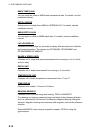
C-MAP NT attributes
Item Description
GOTO CHART DETAILS SETUP
CONTOUR LINES
Same as NavChart
NT
attribute.
BOTTOM TYPE
Select ON to show the bottom composition.
DEPTH SHADE AREA
Sets two values to show the depth areas in three
colors. (0 to left value: Blue, between left and right
values: L-blue, deeper than right value: Gray)
CONTOUR LINES AREA
Sets two depths for which to show contour lines
between them.