


Apollo CNX80 Pilot’s Guide
17
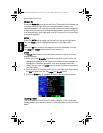
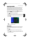
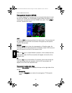
Information on Waypoints (INFO)
Info mode allows you to view information about the selected waypoint.
Examples of selecting a waypoint can be: active Wpt in flight plan, item
selected from Nearest Waypoint list, item selected in Pan mode, etc.
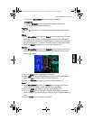
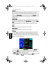
Airport Information
• Identifier, city/facility name, state, country, elevation, type, and fuel
• Position: bearing and distance from present position, sunrise/sun-
set, lat/lon coordinates, and magnetic variation.
• Frequencies
• Map of area and runway
• Runway information: length, lighting, surface type, category type
and frequency
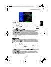
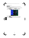
VOR Information
• Identifier, city, state, country, bearing and distance from present
position, frequency, lat/lon coordinates, and magnetic variation.
• Map of area
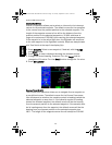
NDB Information
• Identifier, city, state, country, bearing and distance from present
position, frequency, lat/lon coordinates, and magnetic variation.
• Map of area
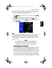
Airway Intersection Information
• Identifier, country, bearing and distance from present position, lat/
lon coordinates, and magnetic variation.
• Map of area
Info
CNX80 Pilot Guide 560-0984-00C Draft1.book Page 17 Tuesday, September 2, 2003 10:36 AM