


12-EN
ALPINE NVD-A802 68-06194Z86-A (EN)
2
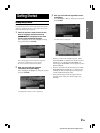
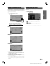
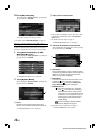
Change the map magnification ratio by
touching [ ] (zoom in) or [ ] (zoom
out) within 5 seconds.
This changes rapidly by touching and holding either
button.
Press the (zoom in) or (zoom out) button
while displaying the map screen.
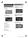
• The 3D landmark icons can be displayed on the map
when map scale is 1/16 mile (100 m) or less.
•The building outlines can be displayed on the map
when map scale is 1/16 mile (100 m) or less.
• The POI icons can be displayed when map scale is 1/8
mile (200 m) or less. For details, see page 62.
•The one-way road icons can be displayed on the map
when map scale is 1/16 mile (100 m) or less.
• If the current map orientation is heading up, it
automatically changes to north up when the map scale
is 50 mile (100 km) or more.
• The 3-D map will automatically be switched to heading
up when the map scale is expanded more than 1/2 mile
(1 Km).
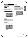
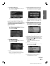
Changing the Map Scale
Change the map magnification ratio upwards or downwards
(in 12 steps).
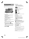
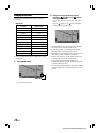
Map scale
•You can change between miles or kilometers in setup,
see page 69.
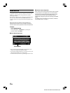
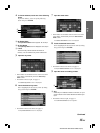
1
Touch [Scale Icon].
The scale bar is displayed.
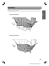
US (mile)
1/32 mile
1/16 mile
1/8 mile
1/4 mile
1/2 mile
1 mile
2 mile
5 mile
15 mile
50 mile
150 mile
350 mile
Metric (km/m)
50 m
100 m
200 m
400 m
1 km
2 km
4 km
10 km
30 km
100 km
250 km
600 km
Scale Icon