


- 77 -
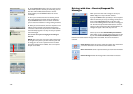
Driving with Live -
Receive Trip Itinerary Updates
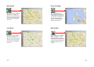
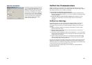
When you are the driver and a Trip Itinerary Update is sent to you, CoPilot Live displays it
on top of all other windows.
You can Accept or Decline the change to your trip itinerary. If you accept the change,
CoPilot Live will automatically start giving route guidance using the new itinerary.
- 78 -
About GPS Technology
The Global Positioning System (GPS), developed by the U.S. Department of Defense, is a
constellation of 24 satellites that orbit the Earth twice daily. Each satellite contains an atomic
clock that is accurate to the nanosecond, and constantly emitting radio waves toward Earth.
GPS sensors (hardware devices for receiving data) can receive these signals from the satellites,
and using their own internal clock can calculate the amount of time it has taken for the signal
to be received. GPS relies on the fact that radio waves travel at the speed of light to calculate
distances, and the exact location of the sensor is figured by combining the data received from
four satellites.
Using the data from these four satellites, GPS is able to give you the latitude, longitude and
elevation of your present location, and also your road speed and direction of travel on a route.
Given the right conditions, a GPS sensor can identify your geographic position anywhere in the
world within a matter of a few meters.
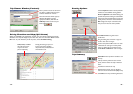
How CoPilot Uses GPS
CoPilot uses the GPS positional data that it receives from the hardware unit you place on your
dashboard to display your current position on a map as you drive. This is called "tracking".
CoPilot also uses the GPS data it receives to guide you along your planned route if you enter a
destination on your mobile device. CoPilot guides you with audible prompts as you drive as
well as on-screen directions.
Tracking will begin automatically when you have satellite reception. In order to get route
guidance, you have to enter a destination on your mobile device. Tracking may also be used
without receiving guidance instructions when you’re in Navigating Mode. In this case, you'll see
your trip tracked on the map on your mobile device as you drive, but you won't see a
highlighted route on the map and you won't be given driving directions.
GPS Accuracy
The GPS signal CoPilot receives from the constellation of satellites has a rated accuracy of
within 5 - 10 meters. This means that 95% of the time the reported location is within 15 - 30
feet of your exact position. CoPilot takes this location information and enhances it further by
"snapping" it to our street and highway network. Occasionally, CoPilot will place you on the
wrong road. If this occurs, keep driving and CoPilot will automatically correct itself and find
your proper position.
At times, CoPilot's GPS tracking will be less accurate or fail to work at all because the unit is
unable to receive satellite signals. Heavy foliage, tall buildings, or any other structures
obstructing communications will interfere with CoPilot's ability to track your location. Like
your car radio, GPS tracking can also be affected by weather conditions if severe. CoPilot will
continue tracking as soon as adequate signals are available. Despite these limitations, you can
expect CoPilot to provide you with useable and accurate information most of the time.
CoPilot will alert you if accurate information is unavailable.