20 SporTrak Color GPS Mapping Receiver
Reference
Cursor
Information
Block
Map Scale
Indicator
Cursor
Icon
Cursor IconCursor Icon
Cursor IconCursor Icon
Cursor Icon
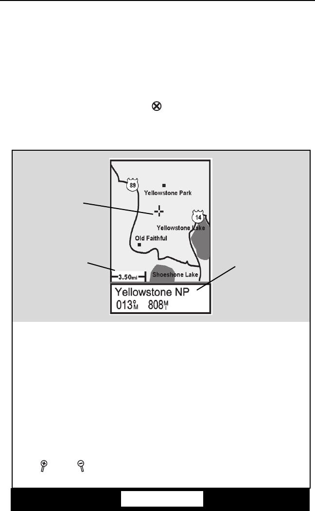
The Cursor Icon pinpoints the
location you have selected by
using the arrow keys.
Map Scale IndicatorMap Scale Indicator
Map Scale IndicatorMap Scale Indicator
Map Scale Indicator
Provides the scale for the map.
The number displayed represents
approximately 1/4 of the screen’s
width. Scale can be changed with
the
IN and OUT buttons.
Waypoint NameWaypoint Name
Waypoint NameWaypoint Name
Waypoint Name
Whenever the cursor is over a
map object, the name of the map
object is displayed, otherwise the
word “cursor” appears. The data
shown in the information block is
the heading and distance from
your present position to the
cursor.
Waypoint
Name
Cursor Mode
In the Cursor Mode, you are provided with a cursor that can be moved on the
map. At the bottom of the display is the information for the position of the
cursor relative to your present position. Also any points of interest that the
cursor is over will be shown.
To access the Cursor Mode, press any arrow on the keypad. A crosshair appears
that can be moved with the arrow keys.
To return to the Position Mode, press [ESC]. The cursor will disappear and
the present position icon will appear centered on the map.


