


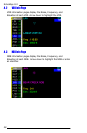


EchoMap v3.0
32
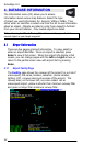
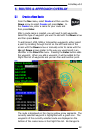
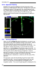
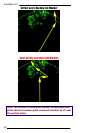
5.5.3 Approach Overlay
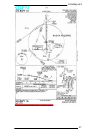
EchoMap has a growing database of airport approach routes,
based on our NOS Approach Plate scans. The approach route data
includes the path(s) of the approach, the missed approach and
any holding patterns associated with the approach. The approach
routes can overlay as vector data on the GPS moving map,
allowing pilots to see the paths of the approaches in relation to
their aircraft.
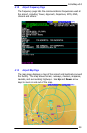
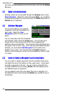
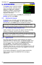
5.5.4 Selecting an Approach
When you set the Direct To target destination to an airport, you
will be given a list of the available runways at the airport. Next to
the runway identifier are characters to indicate the type of
approach overlays available in the database for that runway. You
can select a runway from the list, or you can skip the runway
selection, by pressing Enter at the empty runway id prompt. If
there are any approaches in the database for this runway, you will
then be given a list to select the type of approach. Once an
approach is selected, it will put EchoMap into Approach Mode and
the approach route will overlay on the GPS moving map.
Approach Mode is indicated by a white bar with the name of the
approach.
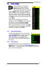
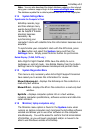
The approach route will automatically target the closest Initial
Approach FIX (IAF). As you fly past the target point, the next
point in the approach will automatically be targeted by the
navigation system. The current target waypoint is displayed in the