


EchoMap v3.0
19
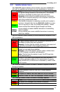
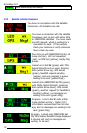
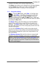
Press the Nav button, select Terrain. In the Terrain
menu select Map: ON and Mode: Both. Next press
Enter to remove the menu.
You can toggle this function
on and off your moving map display by pressing Nav
Enter Enter.
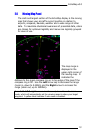
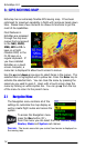
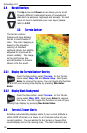
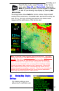
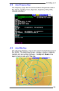
The image below shows both the terrain contour map and alert
overlay at the same time. If NexRAD radar and terrain overlay are
both set on, the map will alternate between the dotted radar
images and the solid colors of the terrain alert.
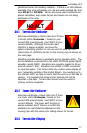
Note - GPS altitude is used to compute tower and terrain alerts. The system
including GPS hardware is not IFR certified and is strictly for supplemental
use only. Even with increased accuracy since the termination of selective
availability, GPS altitude still varies above and below the actual altitude by
several hundred feet. This system is meant to supplement, but not replace,
primary sources of information such as current charts and altimeter settings.
All terrain and obstacle data provided by the US government. Although this
data is believed to be correct, there is the possibility that certain terrain or
obstacle data may be incomplete or inaccurate. If you find any inconsistencies
between this US government data and your current charts or observations
please notify Echo Flight support at 1-800-739-7161.
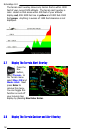
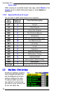
3.9 Moving Map - Display
Settings
The display settings menu
allows you to customize your