


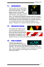


EchoMap v3.0
13
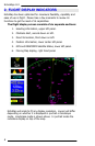
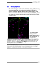
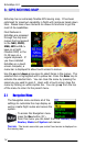
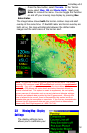
2.6 Moving Map Panel
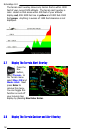
The sixth and largest section of the EchoMap display
is the moving
map that shows your aircraft’s current position in relation to
airports, airspaces, Navaids, weather and a wide range of other
data. To maximize situational awareness of presented data, colors
are chosen for optimum legibility and menus are logically grouped
for ease of use.
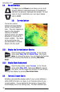
The map range is
displayed in the
upper-
right corner of
the moving map. It
indicates the
distance to the green compass ring or to top edge of the map if the
compass ring is off. Use the Left arrow key to decrease the range
(zoom in, down to 0.25Nm) and the Right arrow to increase the
range (zoom out, up to 2500Nm).
Press both left & right arrows simultaneously to enable auto-zoom
mode, which will automatically set the viewing range to show your target
waypoint. A yellow label indicates if auto-zoom is enabled.