


8 TRACKER950 CHARTPLOTTER Installation and Operation Manual
NAVMAN
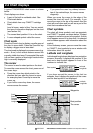
Latitude and longitude
Latitude and longitude are displayed in degrees and minutes:
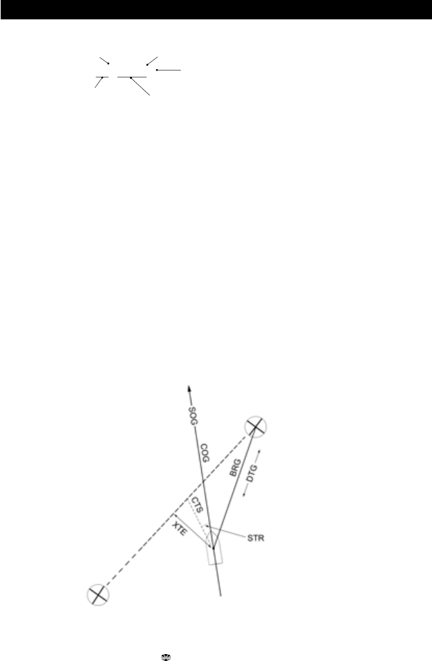
Navigation data
Data displayed on the TRACKER950 has three-letter names.
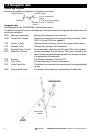
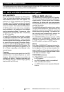
The boat is sailing from the start to the destination and has moved off the original plotted course from the
start to the destination.
BRG Bearing to destination Bearing to the destination from the boat.
COG Course Over Ground Direction in which the boat is moving over the ground. (Note - When
SOG < 0.2 knot COG is not updated.)
CTS Course To Steer Optimum course to steer to return to the original plotted course.
DTG Distance To Go Distance from the boat to the destination.
ETA Expected Time of Arrival At the destination, assuming that SOG and COG remain constant.
SOG Speed Over Ground Current boat speed over the ground. This is not necessarily the
same as the boat speed through the water nor the speed at which
it is approaching the destination.
STR Steering The difference between COG and CTS.
TTG Time To Go The estimated time to reach the destination.
XTE Cross Track Error The distance from the boat to the nearest point of the original plotted
course.
VMG Velocity Made Good The speed at which the boat is approaching the destination.
1-4 Navigation data
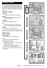
N or S of equator for
latitude
E or W of zero for longitude
Minutes, 0 to 60, to 3 decimal
places
Degrees
Minutes symbolDegrees symbol
43° 12.538' N
Current Boat
position
START
DESTINATION