


Magellan Meridian FAQ – Version 2.0
Page 13 of 30
little screen to see where it says I am, and then I look out the window of the car to see if we’re really driving in the
Pacific Ocean,” which was what one user said when she took her new GPS to Hawaii.
First, you have to understand the difference between routes and tracks.
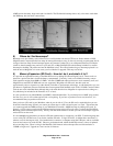
Routes
A route is a trip you plan, shown by “waypoints” (specific points noted by longitude and latitude) connected by a
solid line. There are three basic ways to lay out a route:
• Lay out your route on the GPS itself. This is so-o-o-o cumbersome you will probably only do it once, if ever.
You basically have to create a waypoint for every point you want the route to travel thru, then you go to the
route menu and add each waypoint (one at a time) into a route’s list.
• Lay out your route in your PC using MapSend. This is also cumbersome, since you have to create the waypoints
first, and then connect the dots to create the route. And if you have to reposition the map during the process,
MapSend automatically ends that route and starts a new one. Then you upload the route(s) to your GPS. You
can do this by using the serial cable (which is somewhat slower) or by converting your MapSend data to
Magellan format using gpsbabel and then loading it to your SD card using a card reader (which is faster, unless
you count the time it takes to use gpsbabel). Gpsbabel is a conversion tool available from
http://gpsbabel.sourceforge.net/.
• Lay out your route using other software, such as DeLorme, QuakeMap, ExpertGPS, & others. For example, in
QuakeMap (available from http://www.quakemap.com), you can draw the route and create waypoints in a
single step by clicking the mouse at each point where the route makes a turn. Once again, you must upload the
route to your GPS – either through the serial channel, which is generally handled by the third-party mapping
software, or by converting it to Magellan format using gpsbabel and then writing it to the SD card.
A route is limited to 30 waypoints. So if you have a long route, you must break it down into 30-waypoint sections,
or space your waypoints far apart. (Editor’s note: the Meridian’s firmware has been limited to 30 waypoints until
firmware 4.51 or later. Even with the updated firmware, some programs recognized the 30 waypoint limitation and
may not yet be updated to allow more than 30 waypoints)
Tracks
A track is created or added to by the Meridian every time you turn it on. It tracks where you go by recording
trackpoints at intervals. You can change the intervals at which trackpoints are recorded by Menu>Map Setup
(Display Tab)>Track Mode. If you first turn on your unit in Houston then fly to Hawaii for a bunch of hiking, your
track for your trip will be several thousand miles long.
You can save a track to the SD card (Menu>Card Utilities>Save Track), clear the track from internal memory (from
the Map Screen: Menu>Clear Track), and then record a new track. When you get home, you can download tracks
from the Magellan to MapSend or to one of the other programs. Once again, there are two ways to download your
tracks:
• Connect your Magellan to the PC and download via the serial cable. First load the track you’re interested in
back into the Magellan internal memory (Menu>Card Utilities>Load Track) and then control the download
from the PC software.
• Download from the SD card. Here you have to use gpsbabel to convert from the Magellan format to the format
required by the PC software.
If you save tracks on your PC, you can upload them back to the GPS next time you want to hike or paddle or drive
the same route. Tracks have a 2000 waypoint limitation before it will start writing over the oldest track points.
One user’s trip recipe
First, I check out the area using the aerial and topo maps from QuakeMap. I tried using MapSend, but the maps
aren’t all that accurate, and the process is incredibly cumbersome. The only real use for MapSend IMHO is to load
detail maps to the Meridian GPS, which no other software can do.
Then I create a route that I think might be interesting by clicking on the map.
I upload the route using the serial connection and specifying a baud rate of 57600.