


54
and speed in the boxes provided on simulator screen. The altitude is also
adjustable.
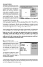
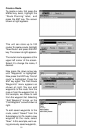
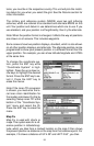
To use the GPS simulator, press the MENU key twice, than select “GPS
Setup”, then “GPS Simulator”. The screen at the bottom of the previous
page appears. Make the desired settings, then turn the simulator on by
highlighting the “Simulator On” box and pressing the ENT key. Press the
EXIT key to erase this menu. A message appears periodically, warning
you that the simulator is on. Repeat the above steps or turn the unit off to
turn the simulator off.
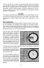
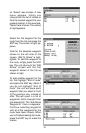
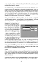
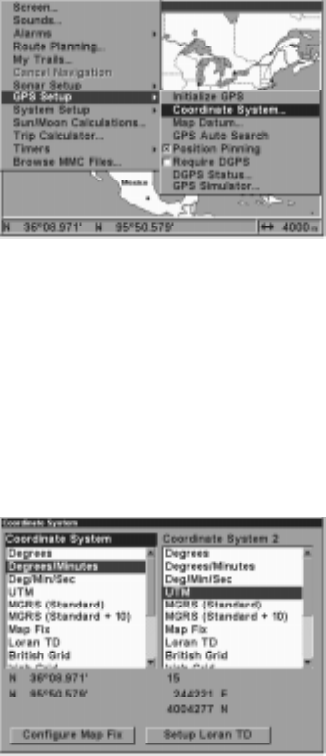
GPS SETUP
Items found under the GPS Setup
menu include initialization, (cov-
ered at the beginning of this
manual), position format, datums,
and more. To use any of these
features, first press the MENU
key
twice
, highlight “GPS Setup”
and press the ENT key. The
screen shown at right appears.
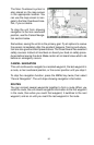
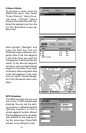
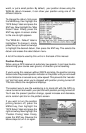
Coordinate System
This unit can show the position in degrees, minutes, and thousandths of a
minute (36° 28.700') or degrees, minutes, seconds, and tenths of a sec-
ond (36° 28' 40.9"). It can also show position in UTM (Universal Trans-
verse Mercator) projection, Loran TD’s, German, Taiwan, British, Irish,
Swedish, Swiss, Finnish, New Zealand, and Military Grid.
To change the coordinate system, select it from the “GPS System” menu.
The screen shown below appears.
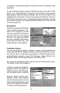
UTM’s are marked on USGS to-
pographic charts. This system di-
vides the Earth into 60 zones,
each 6 degrees wide in longitude.
German, Taiwan, British, Irish,
Swedish, Swiss, New Zealand,
and Finnish grid systems are the
national coordinate system used
only in their respective countries.
In order to use these grid sys