


39
Auto Zoom
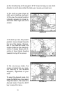
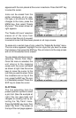
This receiver has an autozoom feature that eliminates much of the button
pushing that competitive units force you to make. It works in conjunction
with the navigation features. First, recall a waypoint. (See the waypoint
section for more information on navigating to a waypoint.) Then, with the
autozoom mode on, the unit zooms out until the entire course shows,
from the present position to the destination waypoint (recalled waypoint).
As you travel towards the destination, the unit automatically begins zoom-
ing in, one zoom range at a time, keeping the destination on the screen.
To turn this featue on, press the MENU key, then highlight “Auto Zoom”
using the arrow keys. Press the ENT key to activate it. Press the EXIT key
to erase the menus. Repeat these steps to turn it off.
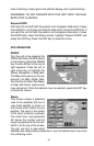
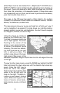
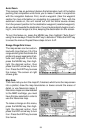
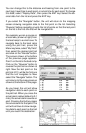
Range Rings/Grid Lines
The map screen can be custom-
ized with rings that are 1/2 of the
range and/or grids that divide the
plotter into equal segments of lati-
tude and longitude. To do this,
press the MENU key, then high-
light the desired option, then
press the ENT arrow key to turn
it on. Press the EXIT key to erase
the menus. The screen at right
shows grids.
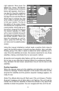
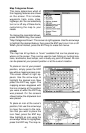
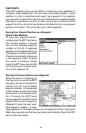
Map Data
This menu lets you turn the map off, if desired, which turns the map screen
into a plotter; draw the map boundaries or boxes around the areas of
detail, or use Navionics maps. If
Navionics maps are downloaded
to the MMC cartridge, you must
have this box selected in order to
use the Navionics map.
To make a change on this menu,
press the MENU key, then high-
light the desired option, then
press the ENT arrow key to turn
it on. Press the EXIT key to erase
the menus.