


41
appears with the icon placed at the cursor crosshairs. Press the EXIT key
to erase the cursor.
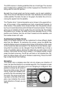
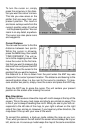
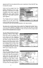
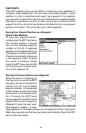
Icons can be erased from the
plotter individually, all of a spe-
cific type, or all at once. To make
changes to the icons, press the
MENU key, then select “Delete
My Icons”. The screen shown at
right appears.
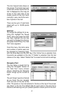
The “Delete All Icons” selection
erases all of the icons from
memory. Use this only if you want
to erase all icons that have been placed on all map screens.
To erase only a certain type of icon, select the “Delete By Symbol” menu.
The icon menu appears. Highlight the icon style that you want to erase
from memory, then press the ENT key. The unit returns to the map screen
with all of the selected icons erased.
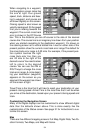
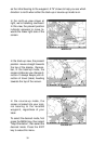
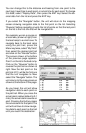
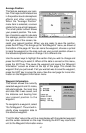
You can delete individual icons by
selecting “Delete From Map”.
Once this menu is selected, the
unit returns to the mapping
screen with the cursor activated
as shown at right. Use the arrow
keys to move the cursor to the
icon that you want to erase. Once
the crosshairs are on top of the
icon, press the ENT key. The icon
is immediately erased. Press the
EXIT key to erase the cursor.
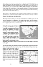
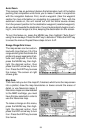
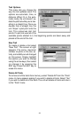
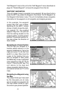
PLOT TRAIL
The line extending from the
present position symbol is called
a plot trail. (See the example at
right.) You can save trails and
navigate an existing trail by se-
lecting the “My Trails” menu.
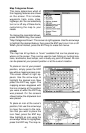
Press the MENU key
twice
, then
select “My Trails”. The screen at
the top of the next page appears.
PLOT TRAIL