


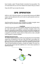

36
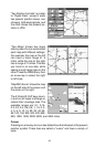
“Two Position Formats” is similar
to “Digital Data”, except it adds
two present position boxes, one
showing latitude/longitude and
the other shows the present po-
sition in UTM.
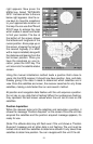
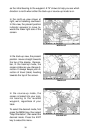
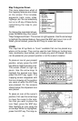
“Two Maps” shows two maps
side-by-side. You can customized
each map with different settings.
For example, the map on the left
can have a zoom range of .5
miles, while the one on the right
has a range of 10 miles. This lets
you zoom-in on one side, while
seeing a much larger area on the
other. Press the PAGES key, then
an arrow key to select the right
or left map.
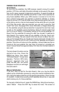
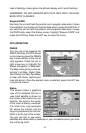
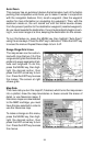
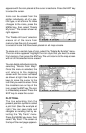
“Map With Sonar” shows the map
on the left side of the screen and
the sonar on the right.
The Z-IN and Z-OUT keys zoom-
in and out all maps to enlarge or
reduce their coverage area. The
available ranges are: 0.1, 0.15,
0.2, 0.3, 0.4, 0.6, 0.8, 1, 1.5, 2, 3,
4, 5, 6, 8, 10, 15, 20, 30, 40, 60,
80, 100, 150, 200, 300, 400, 600,
800, 1000, 1500, 2000, 3000, and 4000 miles.
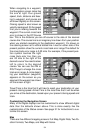
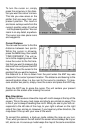
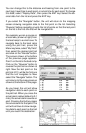
Cursor
Pressing an arrow key turns on two dotted lines that intersect at the present
position symbol. These lines are called a “cursor” and have a variety of
uses.