


1
INTRODUCTION
Thank you for purchasing an Lowrance
®
GlobalMap 12™. With its large
LCD screen, easy to use menus, and outstanding performance, we think
you’ll be happy with this product for many years.
The GlobalMap 12 can be used for fishing, hiking, canoeing, offshore
boating, and just about any other ground-based activity. This product also
takes IMS SmartMap™, C-MAP™, and Navionics™ cartridges, which
show greater detail of land and hydrographic features.
Like most GPS receivers, your GlobalMap 12 doesn’t have a compass or
any other navigation aid built into it. It relies solely on the signals from the
satellites to determine its position. Speed, direction of travel, and distance
are all calculated from position information. Therefore, in order for it to
determine the direction you’re travelling, you must be moving, and the
faster - the better. This is not to say the unit won’t work at walking speeds
- it will. But the faster you travel, the easier it is for the unit to determine
your direction.
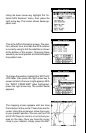
GPS works from satellites that transmit information to the world at very
high frequencies. One disadvantage to this frequency is that it’s “line-of-
sight”. In other words, the signals don’t bounce around like your local
radio or television. If you don’t have a clear view of the sky, or if you’re
inside a metal building, the unit probably won’t be able to pick up the
signals from the satellites. This is common among all GPS receivers. We
have found that using this product inside a car is usually sufficiently close
to the windows and windshield that it works well. However, there is an
optional remote antenna bracket and cable (model PA-2) that lets you
mount the removable antenna on top of the dash, in case it’s required.
Another factor that influences the GPS’ position and navigation capabili-
ties is called selective availability or SA. This is small errors purposefully
injected into the transmitted signal from the satellites. The government
does this to degrade the system’s accuracy to civilian and foreign users.
Even with SA, GPS is the most accurate navigation system ever invented
on such a large scale. The Government’s accuracy specification is 100
meters horizontally and 150 meters vertically 95% of the time. In other
words, the position shown on your GlobalMap 12 could be up to 100 meters
in any direction from your actual position, and the altitude could be plus or
minus 150 meters from what’s shown on the screen, 95% of the time.
One way around the S/A problem is to purchase a DGPS receiver and
connect it to your GlobalMap 12. A DGPS receiver (commonly called a
beacon receiver), picks up correction signals broadcast from ground sta