


43
last known track direction. When you resume speed, all features operate
normally.
When you’re stopped at a traffic light, the track holding feature is useful to
prevent the annoying random numbers from appearing on the display
while you're stopped. This also prevents the unit from rotating the map in
all directions when it's in the "track-up" mode. This feature is useful when
you're using the GlobalMap 12 while hiking, horseback riding, or other
typically slow-speed activities.
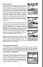
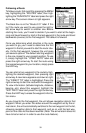
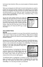
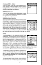
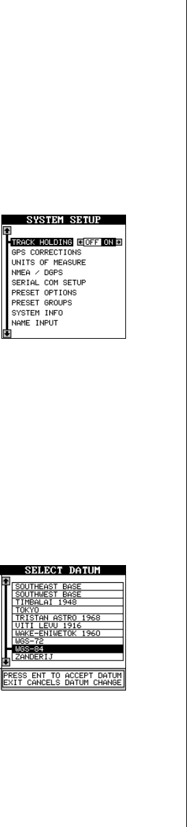
To turn the track holding feature off, press the
MENU key, then press the up or down arrow keys
until the “System Setup” menu appears, then press
the right arrow key. The screen shown at right ap-
pears. The track holding menu is at the top of this
screen. Press the left arrow key to turn the track
holding feature off. Press the EXIT key to erase
this menu.
GPS CORRECTIONS
DATUM
Maps and charts are based on a survey of the area that’s covered by the
map or chart. These surveys are called “Datums”. Maps that are created
using different datums will show the same latitude/longitude in slightly
different locations.
All datums are named. The GPS system is based on the WGS-84 datum,
which covers the entire world. Other datums may also cover the entire
world, or just a small portion. By default, the GlobalMap 12 shows your
position on the map using the WGS-84 datum.
However, it can show your position using one of
99 different datums.
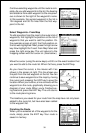
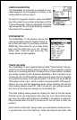
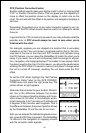
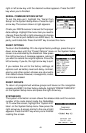
To change the datum, first highlight the “GPS Cor-
rections” label on the “System Setup” menu and
press the right arrow key. Now highlight the “Se-
lect Datum” label. Press the right arrow key. A
screen similar to the one at right appears.
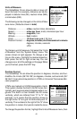
The WGS-84 label is highlighted. To change it, simply press the up or
down arrow keys until the desired datum is highlighted, then press the
ENT key. This selects the datum and erases the datum menu. The
GlobalMap 12 is now using the datum you selected.