


78
Navigation Submenu
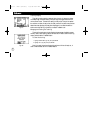
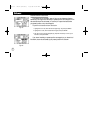
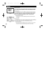
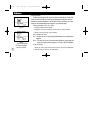
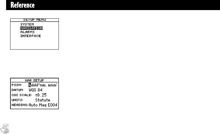
The navigation setup submenu page (Fig. 78a) is used to select units of measure-
ment for position formats, map datums, CDI scale, units, and heading information.
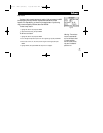
Position Formats
The default position format for the GPS II
+
is latitude and longitude in degrees
and minutes (hdddºmm.mmm’). You may also select degrees, minutes and seconds
(hdddºmm’ss.s’’); degrees only (hddd.dddddº); UTM/UPS coordinates; or British,
German, Irish, Maidenhead, Swedish, Swiss, or Taiwan, or User grid formats.
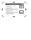
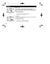
To select a position format:
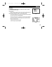
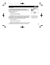
1. Highlight the ‘posn’ field, and press ENTER (Fig. 78b). Select the desired setting, and
press ENTER.
User Grid Option
The user grid option lets you create a user-defined position format by establishing
factors such as longitude of origin, scale, and false Easting or Northing.
To define a user grid:
1. Select ‘User Grid’, and press ENTER. Enter values for longitude origin, scale, and false
Easting and Northing, and press ENTER. Highlight ‘SAVE?’, and press ENTER.
Fig. 78a
Fig 78b
gps ii + Mon (final?) 2/9/98 4:25 PM Page 78