


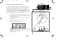
GPS APPROACH EXAMPLES
In the examples that follow, the GPS waypoints are shown along the approach
path. In some cases, intermediate database waypoints have been added to approaches.
These waypoints are named using lower case letters using the following convention
(the most common database waypoints are defined below). Note that these waypoints
are not charted on NOS approach plates. They do appear on current Jeppesen
approach charts.
• dyyyj— DME arc waypoint where yyy is the radial from the
reference facility (VOR) and j represents the arc
radius (e.g., “a”= 1 nm, “b”= 2 nm, etc.)
• cfxx or cfxxx— course fix for runway xx or radial xxx
• ffxx or ffxxx— final approach fix for runway xx or radial xxx
• rwxx— runway xx threshold
• nxxhp— NDB approach runway xx intermediate holding
pattern waypoint
• maxx or maxxx— missed approach point for runway xx or radial xxx
• vxxhp— VOR approach runway xx intermediate holding
pattern waypoint
86
SECTION
5
APPROACH NAV
GPS Approach
Examples
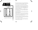
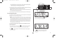
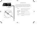
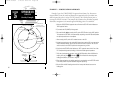
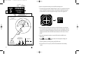
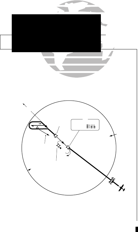
BAY CITY
IAF
344 BYY
307°
10 NM
082°
262°
MAGUS
307°
1800
116 ° (7.9)
n13hp
ff13
387
Ref: NDB RWY 13 approach
at Bay City TX (3R1)
155xlb manual 1/12/99 4:06 PM Page 86