


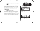
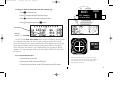
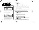
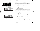
Once you begin viewing restrictions, you can view any additional frequencies for
the selected airport by rotating
K
. (Note: An arrow prompt displayed next to the air-
port identifier indicates additional frequencies are available.) You can also view the
other airport information pages by rotating
O
. Information contained on these pages
is covered in Section 2. To return to the NAVCOM page, press
N
.
Some frequencies in the NAVCOM page have tags which designate their usage:
‘tx’ – transmit only ‘rx’ – receive only
‘pt’ – part time frequency
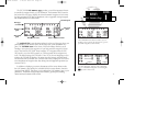
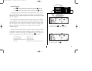
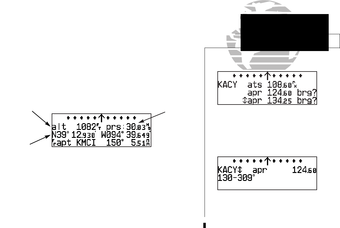
The GPS 155XL position page displays the graphical CDI along with your present
latitude and longitude, altitude and a reference waypoint field. The altitude and refer-
ence waypoint fields are selectable to configure the page to your own preferences and
current navigation needs.
An altimeter setting field appears on the position page when you are within 30 nm
of a destination airport. The altimeter setting field allows you to define the current
barometric pressure, which is used by the integrity monitoring to crosscheck altitude.
The altitude field can display either the present altitude, minimum safe altitude
(MSA) or enroute safe altitude (ESA). MSA is the recommended minimum altitude
within a ten mile radius of your present position. ESA is the recommended minimum
altitude within ten miles of your course on an active route or direct-to. MSA and ESA
altitudes are calculated from information contained in the database and generally
include mountains, buildings and other permanent features (see following page).
17
SECTION
1
NAV KEY
NAVCOM &
Position Pages
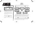
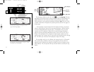
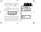
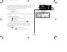
NAVCOM page with receive only (rx) frequency
and frequencies with restrictions (brg).
Frequency restrictions on 124.60, showing range
of applicable radials from 130º through 309º.
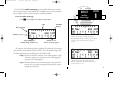
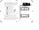
Altitude, MSA or ESA
Position (lat/lon)
Reference Waypoint Field
{
Altimeter Setting
Field
(user-selectable)
155xlb manual 1/12/99 4:05 PM Page 17