


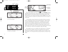
The next page available from the GPS 155XL’s
N
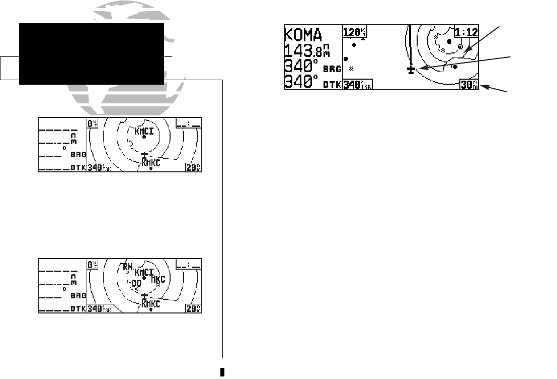
key is the map page. The map
page displays your present position, using an airplane symbol (in track up mode) or a
position diamond (in other orientation modes), along with nearby airports, VORs,
NDBs, intersections, user waypoints and airspace boundaries. Note: If the GPS 155XL
is unable to determine a GPS position, the present position symbol will not appear on
the map page.
The map display occupies the right side of the display and shows your position
relative to nearby airports, navaids, user waypoints and airspaces. Different symbols
are used to distinguish between waypoint types. The identifiers for any on-screen
waypoints can also be displayed. Special-use and controlled airspace boundaries
appear on the map, showing the individual sectors in the case of Class B or Class C
airspace. The map display can be configured to display airports, navaids, user way-
points, airspaces only at certain scales or these items may be disabled entirely (see page
95). This allows you to de-clutter the map display at larger scale settings.
The map display can be set to 14 different scale settings (from 0.5 to 300 nautical
miles, statute miles or kilometers) during en route operation; while in terminal or
approach mode 12 different scale settings are available (with the two highest en route
scales disabled). The scale represents the top-to-bottom distance covered by the map
display.
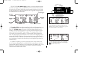
14
SECTION
1
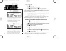
NAV KEY
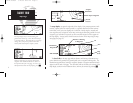
Map Page
Data
Fields
Present
Position
{
Map Display
Map Scale
The map page, showing airports, airspaces, VORs
and NDBs on the map display.
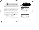
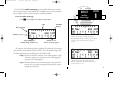
The map page, showing only airports and air-
spaces on the map display.
155xlb manual 1/12/99 4:05 PM Page 14