


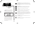
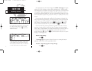
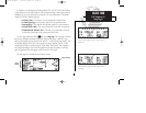
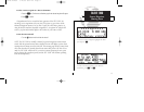
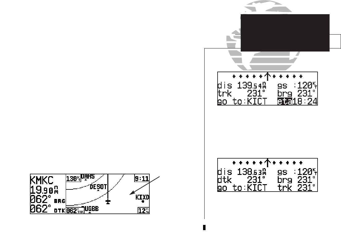
In addition to the destination field and graphical CDI, the GPS 155XL NAV summa-
ry page features five selectable fields for various navigation data so that the page may be
configured to your own preferences (see Section 1 for more information). The default
settings for the NAV summary page are:
• Distance (dis)— The distance to your destination in nautical miles
• Ground Speed (gs)— Your present speed over the ground in knots
• Bearing (brg)— The direction from present position to your destination
• Desired Track (dtk)— The course between the ‘from’ and ‘to’ waypoints
• Estimated Time Enroute (ete)— The time to your destination (in hours
and minutes) based upon your present speed and course
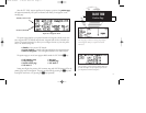
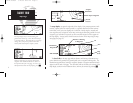
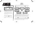
The next page available from the
N
key is the map page. The map page combines
the primary navigation information from the NAV summary page – distance to way-
point, ground speed, bearing, desired track and ETE – with a moving map display. The
moving map display shows your current position (using an airplane symbol or a dia-
mond symbol) relative to nearby airports, VORs, NDBs, intersections, user waypoints
and airspace boundaries. Notice that the graphical CDI does not appear on the map
page; the graphical CDI does appear on all other GPS 155XL pages.
The map page can be divided into two main sections:
5
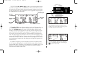
NAV summary page with ‘dtk’, ‘brg’ and ‘trk’
displayed.
NAV summary page with ‘trk’, ‘brg’ and ‘eta’
displayed.
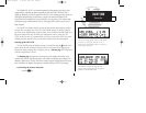
TAKEOFF TOUR
NAV Summary &
Map Pages
Data
Fields
{
Map Display
155xlb manual 1/12/99 4:05 PM Page 5