


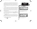
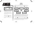
The map display may be oriented along your
ground track (track up), course (desired track up)
or fixed at north up. Desired track up or north up
settings show your present position with a dia-
mond symbol instead of the airplane symbol.
TAKEOFF TOUR
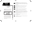
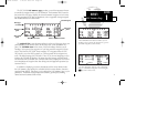
Map Page
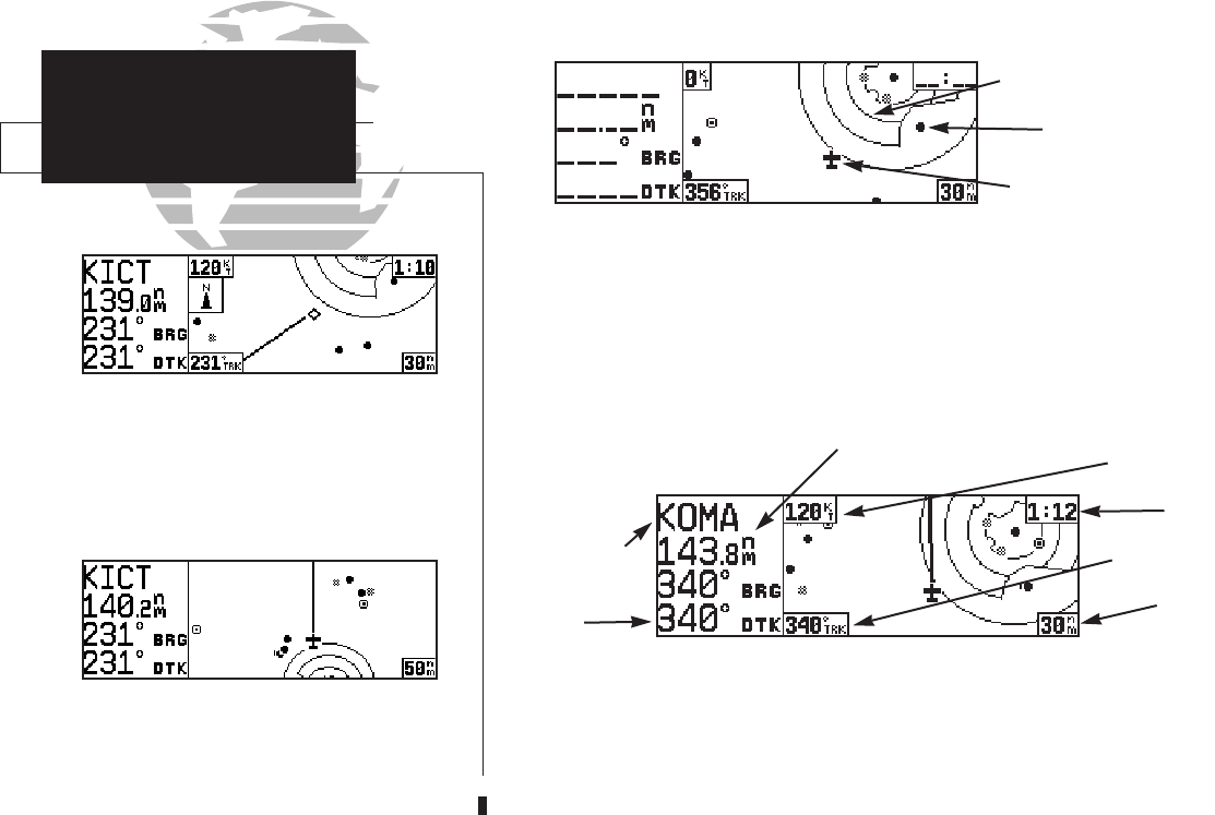
Distance and bearing to waypoint, destination
waypoint name and desired track are shown on
the left hand side of the map page. To remove the
data fields that border the map display, press \.
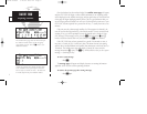
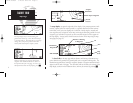
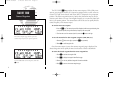
The map display occupies the right side of the display. Your present position is indi-
cated by a plane symbol (in track up mode) or a position diamond (in other orienta-
tion modes), with your route displayed as a solid line. Nearby airports, navaids and
user waypoints may be depicted on the map—with unique identifying symbols for each
waypoint type. Boundaries for special use and controlled airspaces can also appear on
the map display. You may select which features are shown on the map using the map
setup page (see page 97).
The data fields on the map page indicate distance and bearing to destination way-
point, desired track, ground track, ground speed, time to waypoint and map scale. The
destination waypoint name, bearing to waypoint, distance to waypoint and desired track
appear on the left side of the page. The other data fields are located at the corners of the
map display, as shown in the illustration above, and may be removed by pressing
\.
6
Present
Position
Airspace
Boundaries
Airport Waypoint
Destination
Waypoint
Map
Scale
ETE
TRK
DTK
Distance & Bearing
to Waypoint
GS
155xlb manual 1/12/99 4:05 PM Page 6