


18
SECTION
1
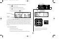
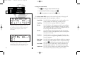
To change the altitude field:
1. Press
C
to obtain a cursor.
2. Rotate
O
until the ‘alt/esa/msa’ field is highlighted.
3. Rotate
K
to display the desired data. Press
C
to return to normal navigation.
The position page also features a reference waypoint field, located at the bottom of
the page, to indicate your bearing and distance from a selected waypoint. The reference
waypoint field can display the following:
• Range, bearing and identifier from the nearest airport (default), VOR, NDB,
intersection, or user waypoint
• Range, bearing and identifier from a user specified waypoint
During DME arc approach operations, the reference field will automatically display
the DME reference as long as the ‘active to’ waypoint is part of the DME arc.
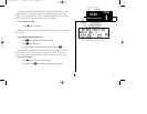
To change the reference waypoint field to display the nearest airport, VOR, NDB,
intersection, user waypoint or the range and bearing from a user selected waypoint:
1. Press
C
to activate the cursor.
2. Rotate
O
to highlight the category field after the
f
r.
3. Use
K
to choose which waypoint type you would like displayed. (Choose ‘wpt’ if you would
like range and bearing from a specific waypoint to be displayed.)
4. Press
C
to remove the cursor, or:
If you have selected ‘wpt’:
5. Rotate
O
to advance the cursor to highlight the identifier field.
6. Use the
K
and
O
knobs to enter the identifier name. (This waypoint identifier can be an
airport, VOR, NDB, intersection, or user waypoint.) Press
E.
7. Press
C
to confirm the selection.
This allows the distance and bearing from any waypoint to be displayed continuous-
ly, which may be useful when an approach reference is not the closest navaid.
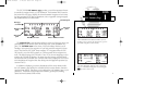
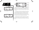
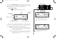
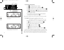
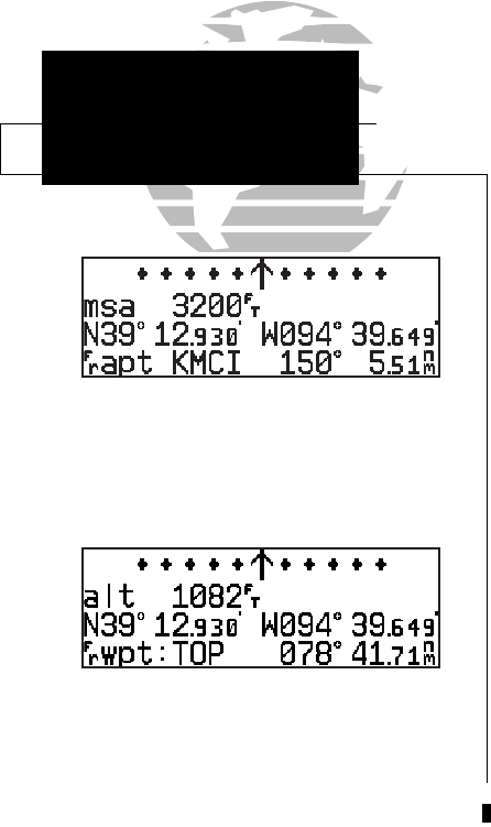
Position page displaying the ‘TOP’ VOR as the ref-
erence waypoint. This configuration can be used to
help monitor your distance and radial from a
waypoint of your choice. (Note: the waypoint cate-
gory is listed as ‘wpt’ rather than ‘VOR’ because
the GPS 155XL is not using the nearest VOR.)
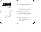
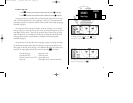
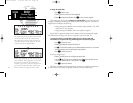
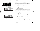
The position page displaying MSA. MSA and ESA
are based on data stored in the NavData card.
This information cannot be solely relied upon as
an absolute measure of safe altitude in your area.
Consult current charts and NOTAMS.
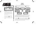
NAV KEY
Position Page &
Reference Waypoints
155xlb manual 1/12/99 4:05 PM Page 18