


Section 4
Nearest Waypoints
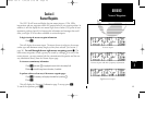
The GPS 150 will locate and display the nine nearest airports, VORs, NDBs,
intersections and user waypoints within 200 nautical miles of your current position. In
addition, it will also display the two nearest Flight Service Station (FSS) points of com-
munication, and any Special Use Airspace alert information and messages that could
affect your flight. SUAs are either controlled or restricted airspace.
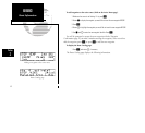
To begin viewing the nearest waypoint information:
1. Press
T
.
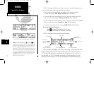
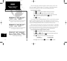
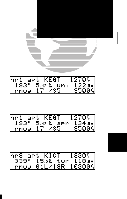
This will display the nearest airport. The airport shown is subject to the runway
surface type and minimum runway length you may have selected. (See Section 5,
page 56). To scroll through the next eight nearest waypoints, rotate
K
. The
other nearest waypoints of each type may be viewed by rotating
O
. For any of the
nearest airports, you may examine both the communication frequencies and the run-
way information directly from the Nearest Airport page.
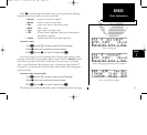
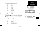
To view more comm/runway information:
1. Press
C
and rotate
O
to highlight the comm field or the runway field.
2. Rotate
K
to scroll through more information, if available.
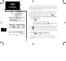
To perform a direct-to from any of the nearest waypoint pages:
1. Press
C
, if necessary, and highlight the identifier by rotating
O
.
2. Press
D
.
This will display the Waypoint Confirmation page. To accept, press
E
.
To cancel the operation, press
\
.
49
REFERENCE
Nearest Waypoints
Section
4
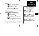
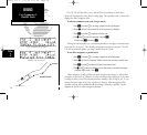
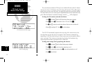
Nearest airport with other frequency information.
Nearest airport
Eighth nearest airport.
150man rev E 7/24/98 3:10 PM Page 49