


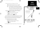
The GPS planning function allows you to make sure there are no GPS coverage
outages for any location or waypoint, any day of the year. Now that the GPS constellation
is complete and has been declared operational by the U.S. Department of Defense, it
is unlikely that instances of poor coverage will occur.
However, if satellites are damaged or are no longer functioning before new ones
can be deployed, the GPS 150 cannot use data from those satellites in calculating
position, speed, or course information. The GPS 150 will obtain information about
the condition of the constellation from other operational satellites and then determine
which ‘healthy’ satellites will be in view at any point on the earth.
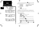
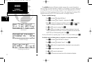
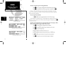
To check GPS coverage:
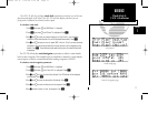
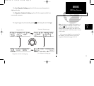
1. Press
N
and rotate
O
until NAV Menu 2 is displayed.
2. Press
C
and rotate
O
until ‘GPS Plan?’ is highlighted. Press
E
.
3. Use
K
and
O
to enter the waypoint at which you would like to check coverage, or
leave it blank to use your current position. Press
E
.
4. Use
K
and
O
to enter the day, month and year of the information desired.
Current date will be displayed automatically. Press
E
.
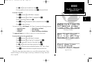
5. Rotate
K
to select which fix you require, either a 2D or 3D position.
(A 2D position will not contain altitude). Press
E
.
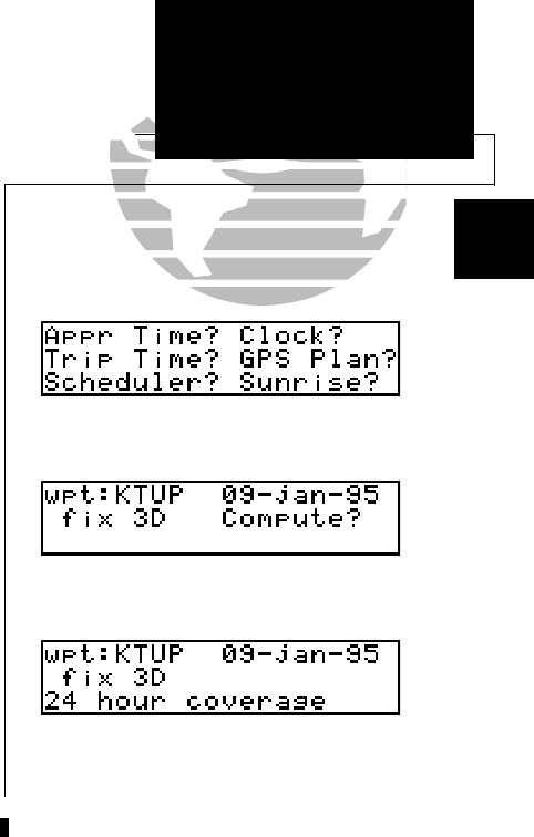
6. The ‘Compute?’ field will be highlighted automatically. Press
E
to compute information.
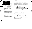
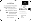
When the computations are complete, the GPS 150 will display the times (of 15
minutes or greater) of poor GPS coverage. They will be displayed on line three and, if
more than two exist, may be viewed by rotating
K
. If no 15 minute periods of poor
coverage are found, the GPS 150 will display ‘24 hour coverage’.
21
REFERENCE
GPS Planning
Section
1
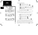
GPS Planning (checking GPS coverage)
NAV Menu 2
GPS Planning (with 24 hour coverage)
150man rev E 7/24/98 3:10 PM Page 21