


46
Reference
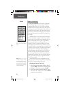
Position Format
The default position format (and the one most com-
monly used) for the eTrex Summit is latitude and longi-
tude in degrees and minutes (hdddº mm.mmm). You may
also choose from 17 other position formats. There is also
a “User” position format which allows you to approximate
custom-designed grids. For more information on grids
and datums we recommend you visit the National Imag-
ery and Mapping Agency at http://www.nima.mil.
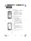
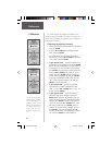
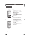
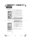
To change the Position Format:
1. Press the PAGE Button and switch to the MENU
Page. Press the UP or DOWN Button and highlight
‘SETUP’. Press ENTER. Use the UP/DOWN Buttons
to select ‘UNITS’. Press ENTER. The UNITS Page
appears.
2. Press the UP or DOWN Button and select the ‘POSI-
TION FRMT’ fi eld. Press ENTER.
3. Press the UP or DOWN Button and select the desired
format. Press ENTER. Press PAGE to get back to the
page of your choice.
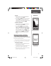
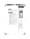
Map Datums
A map datum is a reference model of the earth’s shape.
Every map uses a map datum. The map datum is usually
listed in the title block of the map. If you are comparing
GPS coordinates to a paper map or other reference, the
map datum in the eTrex Summit should match the hori-
zontal map datum used to generate the chart or other
reference.
The default datum in the eTrex Summit is WGS 84
(World Geodetic Survey, 1984). You should only change
the datum if you are using maps or charts that specify a
different datum than WGS 84. If no datum is specifi ed,
you can select each datum applicable to your region until
you fi nd the datum that provides the best positioning at a
known point. You may also choose the “User” datum for
use with custom-designed grids.
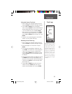
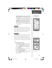
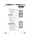
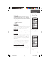
Data Entry Pages exist for the
User Grid Format and the User
Datum Setup. These pages allow
you to confi gure the eTrex Summit
for compatibility with custom
designed grids. We recommend
surfi ng the net for links to Garmin
user-grid and user datum informa-
tion. There are also excellent
navigation and GPS articles avail-
able on-line which will enhance
your overall knowledge of GPS.
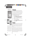
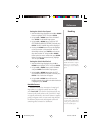
Eighteen position formats are
available in the eTrex Summit.
Map Datums
User Datum
User Grid
190-00193-00_0D.indd 02/12/01, 10:09 AM46