


41
Reference
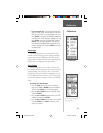
Elevation:
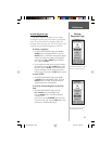
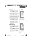
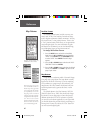
1. With the TRACK LOG Page displayed highlight a
‘SAVED TRACK’ and press ENTER.
2. Using the UP or DOWN Button select ‘ELEVATION’
and press ENTER. The elevation profi le for the
‘SAVED TRACK’ will be graphically displayed. When
fi nished highlight ‘OK’ and press ENTER.
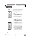
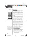
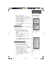
To delete a saved track:
1. With the ‘TRACK LOG’ page displayed highlight a
‘SAVED TRACK’ and press ENTER.
2. Press the UP or DOWN Button and highlight
‘DELETE’. Press ENTER. A confi rmation window
appears asking ‘DO YOU REALLY WANT TO DELETE
THIS TRACK?’. If you do, press the UP or DOWN
Button and highlight ‘YES’. Press ENTER. If you
change your mind, press the UP or DOWN Button
and select ‘NO’ Press ENTER (or you can press
PAGE to exit at any time). The tracks remain in
memory.
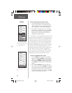
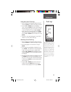
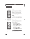
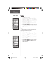
Calibrating the Compass and Altimeter
The ‘CALIBRATE’ selection on the MENU Page allows
the Electronic Compass and the Altimeter to be calibrated
for the most accurate performance.
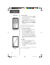
The procedure for calibrating the Electronic Compass
was covered on page 10 but here are some helpful tips.
The Electronic Compass:
1. The compass will need to be calibrated every time
that the batteries are changed.
2. The compass will not be accurate if used in a car or
around items that radiate a magnetic fi eld.
3. When using the compass , hold the unit as level as
possible for optimum performance.
Track Log Elevation Profi le
Calibration Page
Calibration
190-00193-00_0D.indd 02/12/01, 10:08 AM41