


42
Reference
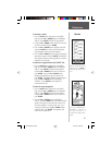
The eTrex Summit will calibrate the altimeter auto-
matically using GPS altitude. If you know the exact cur-
rent elevation or barometric pressure, you can calibrate
the altimeter manually.
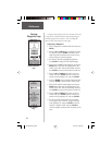
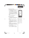
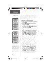
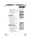
Calibrating the Altimeter manually:
1. With the MENU Page displayed highlight ‘CALIBRATE’
and press ENTER.
2. Using the UP or DOWN Button highlight ‘ALTIM-
ETER’ and press ENTER.
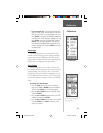
3. You will be asked ‘DO YOU KNOW THE CORRECT
ELEVATION’? Using the UP or DOWN Button select
‘YES’ or ‘NO’ and press ENTER.
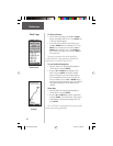
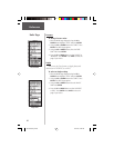
4. If you selected ‘YES’— the ENTER CORRECT ELE-
VATION Page will be displayed. Pressing the DOWN
Button will move the highlight to the next number in
the elevation fi eld. With the desired digit selected,
press ENTER to activate the drop down number list.
Using the UP or DOWN Button select the correct
number then press ENTER. When all numbers are
entered correctly, highlight ‘OK’ and press ENTER.
A message ‘CALIBRATION COMPLETED SUCCESS-
FULLY’ will be displayed, highlight ‘OK’ and press
ENTER to end the calibration.
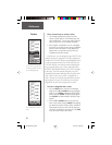
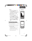
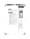
5. If you selected ‘NO’—you will be asked ‘DO
YOU KNOW THE CORRECT BAROMETRIC PRES-
SURE’. Using the UP or DOWN Button, select ‘YES’
or ‘NO’ and press ENTER.
6. If you selected ‘YES’— the ENTER CORRECT
PRESSURE Page will be displayed. Pressing the
DOWN Button will move the highlight to the next
number in the pressure fi eld. With the desired digit
selected, press ENTER to activate the drop down
number list. Using the UP or DOWN Button select
the correct number then press ENTER. When all
numbers are entered correctly, highlight ‘OK’ and
press ENTER. A message ‘CALIBRATION COM-
PLETED SUCCESSFULLY’ will be displayed, highlight
‘OK’ and press ENTER to end the calibration.
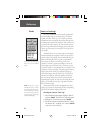
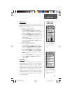
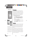
The eTrex Summit can auto-
matically calibrate the altim-
eter using GPS altitude. For
optimum performance of the
Altimeter, you should perform
the calibration procedure
entering either the correct
elevation or barometric pres-
sure.
Calibration
190-00193-00_0D.indd 02/12/01, 10:09 AM42