


Preferences
63
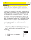
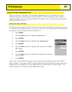
Setting the Map Units
In the Map Units option of Preferences you can select which units of measure for navigation
data, the north reference, the coordinate system and the map datum that will be used by the
eXplorist.
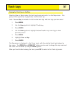
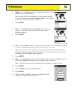
Selecting Navigational Units of Measure
The eXplorist can be set to display navigation data in Miles/Yd/MPH, Miles/Ft/MPH,
NM/Ft/Knots, NM/M/Knots or KM/KPH.
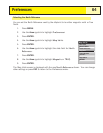
1. Press
MENU.
2. Use the
Arrow joystick to highlight Preferences.
3. Press
ENTER.
4. Use the
Arrow joystick to highlight Map Units.
5. Press
ENTER.
6. Use the
Arrow joystick to highlight the data field for Nav
Units
.
7. Press
ENTER.
8. Use the
Arrow joystick to highlight the desired navigational units of measure.
9. Press
ENTER.
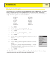
The
Map Units screen is displayed with the new Nav Units shown. You can change other
settings or press
ESC to return to the Preferences menu.
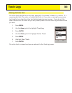
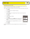
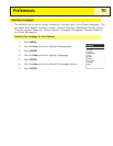
Map Units
Miles/Ft/MPH
Magnetic
Nav Units
North Reference
Coord System
Map Datum
Lat/Lon
WGS84