


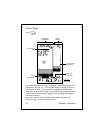
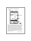

46
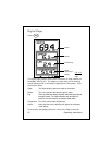
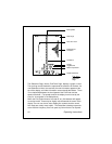
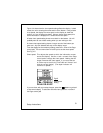
The units used here are chosen using the entry for Depth
Units in the System Setup Menu. If you have selected feet
(FT) or fathoms (FA), the distance shown here will be
measured in feet. If you have selected meters (M), the
distance shown here will be in meters.
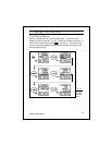
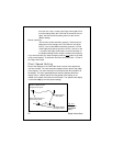
Bottom/Shore
Indication This indicates the area where the transducer beam is start-
ing to see the bottom, shore, or some other object. Again,
remember that the beam is looking sideways, so this could
really represent the bank of a stream or structure under a
dock or pier.
Depth This is the depth directly below the boat. Even when the
Sidelooker feature is turned on, the downward-looking
transducer is still used to measure the depth.
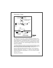
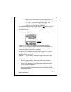
The Sidelooker feature has settings for Range and Sensitivity which are
separate from the Range and Sensitivity settings used for the standard
FishFinder Page. See Section 4 for details.
Operating Instructions