


User’s manual NAVIGON 33xx | 43xx max
- 48 - Navigation
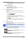
In the case of a multi-leg route, the distance and the estimated driving
time for each leg are displayed.
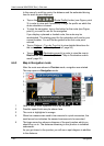
► Tap on the (Route Profile) button (see Figure, point
3) in order to view and if necessary change the profile on which the
route calculation is based.
► To start the navigation, tap on the button for the route (see Figure,
point 4) you want to use for the navigation.
If you display a planned or loaded route, the route may be
recalculated. The starting point for the calculation will now be your
current location. You will first be guided to the first route point
entered.
► Tap on Options > Turn-by-Turn List to view detailed directions for
the route. (Refer to "Turn-by-Turn List” page 56)
► Tap on (Destination search) in order to view the map in
Destination search mode. (Refer to "Map in Destination search
mode” pag
e 52)
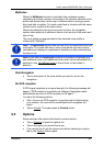
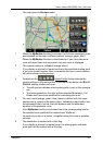
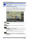
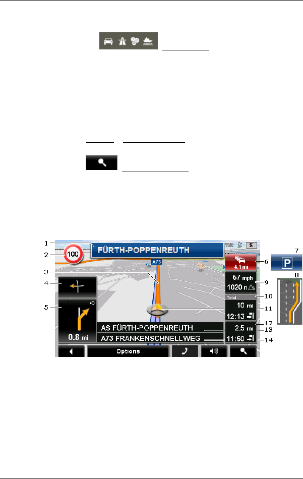
6.6.3 Map in Navigation mode
After the route was shown in Preview mode, navigation was started.
The map opens in Navigation mode.
1 Here is shown what signposts should be followed.
2 Possible speed limits may be shown here.
3 The route is highlighted in orange.
4 When two manoeuvres need to be executed in quick succession, the
small arrow box indicates the second manoeuvre to be executed.
5 The large arrow box shows a diagram of the next junction which you
should turn on to. The distance remaining to this junction is indicated
underneath.
As you get closer to the junction you will see a spot diagram in addition
to the distance: