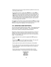
• Rotate the left outer knob one step clockwise to position the cursor over
the runway surface criteria.
• Turn the left inner knob to select either HRD SFT or to select HRD. If
HRD SFT is chosen, then both hard and soft surface runways meeting
the required runway length will be included in the nearest airport list. If
HRD is chosen, then only hard surface runways will be included. Hard
surface runways include concrete, asphalt, pavement, tarmac, bitumen,
and sealed. Soft surface runways include turf, gravel, clay, sand, dirt,
ice, steel matting, shale, and snow.
For example, if the minimum runway criteria selected is 2200 feet in length
and HRD surface, then only airports having a hard surface runway at least
2200 feet in length will be displayed in the nearest airport list.
10.0 CREATING USER WAYPOINTS
Up to 250 user-defined waypoints may be created. These waypoints must
contain an identifier, latitude, and longitude. This manual describes the
most common methods of creating user-defined waypoints.
Regardless of which of the three methods described below is utilized for
creating a user-defined waypoint, it is first necessary to enter a unique
identifier for the waypoint. The identifier can be one to five characters in
length. To select the identifier:
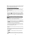
• Use the right outer knob to select the supplemental (SUP) type way-
points.
• Press the right C to turn on the right cursor function. The cursor will
appear over the first character position of the identifier.
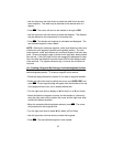
• Use the right inner knob to select the first character of the identifier.
• Turn the right outer knob one step clockwise to position the cursor over
the second character, and then use the right inner knob to select the
desired character.
• Use the right outer and inner knobs as described above to finish
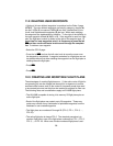
selecting the identifier. The following text should now be displayed:
CREATE NEW
WPT AT:
USER POS?
PRES POS?
35


