


34 Trail Guide
™
Owner’s Manual
E
N
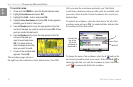
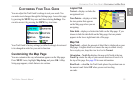
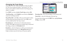
CUSTOMIZING YOUR TRAIL GUIDE > CUSTOMIZING THE MAP PAGE
AutoZoom—when On, the Map page zooms in and out as you
travel. As you approach a turn, the Map page progressively zooms
in. After the turn is completed, it zooms out to show the next turn.
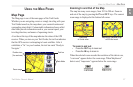
Color Mode
—choose between Land and Water. Unless you are
using a marine map, such as BlueChart, you will probably keep
Land, which is the default value. Water displays the color of water
as white instead of blue.
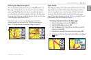
Line, Point, City, and Area Tabs
Line tab—controls how the track log, railroads, and street labels
are displayed on the Map page.
Point tab—controls how My Locations, exits, and points of
interest (POIs) are displayed on the Map page.
City tab—controls how cities of various sizes are displayed.
Area tab
—controls how rivers, lakes, parks, and points of interest
are displayed on the Map page.
The Line, Point, City, and Area tabs contain two common settings,
Text Size and Hide Above:
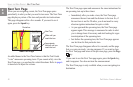
Text Size—specifies how large or small the names of items appear
on the map. If you do not want the name of an item to appear
on the Map page, select Off in the Text Size field. Names with
Medium and Large letters also appear in bold.
Hide Above—specifies the maximum zoom range at which a map
item appears. If Auto is selected, the maximum zoom range is
determined by the Detail setting. If Off is selected, the item is not
shown. Some map data is only visible at certain zoom ranges.
Restoring Map Setup Default Settings
You can restore map settings for each individual tab or for all tabs.
To
restore settings to the map setup:
1. Press MENU twice, highlight Map Setup, and press OK.
2. Open the tab on which you want to restore the settings.
3. Press MENU.
4. To restore the settings on the open tab, highlight Restore
Map Settings and press OK.
5. To restore all map setup settings, highlight Restore All Map
Settings and press OK.