


18
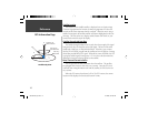
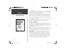
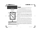
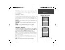
Setup Map — ‘Area’ Tab
The ‘Area’ Tab contains the ‘Text’ and ‘Zoom’ settings for River/Lakes, Parks,
Other, and Metro. To change a setting, highlight the fi eld then press ENTER.
Make your new selection, then press ENTER to accept the selection.
River/Lake —
Rivers and Lakes will appear shaded on the map.
Park —
Area Parks will appear as a shaded area.
Other —
Geographical areas such as shopping centers and university cam-
puses will appear as a shaded area.
Metro —
Metropolitan areas will appear as a shaded area.
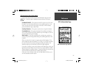
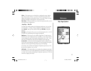
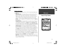
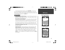
Setup Map — ‘Topo’ Tab
The ‘Topo’ Tab contains the ‘Text’ and ‘Zoom’ settings for Major Contour,
Intermediate Contour, and Minor Contour Lines. The Land Cover option
has a ‘Zoom’ setting. To change a setting, highlight the appropriate fi eld then
press ENTER. Make your new selection, then press ENTER to accept the
selection.
The Contour Line settings are used to de-clutter the map. If ‘Auto’ is the
selected ‘Zoom’ setting, the Major and Minor Contour Lines will be displayed
at a higher Map Zoom Scale setting.
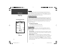
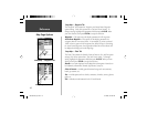
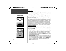
Setup Map — ‘City’ Tab
The ‘City’ Tab contains the ‘Text’ and ‘Zoom’ settings for Large City, Medium
City, Small City and Small Towns. To change a setting, highlight the fi eld then
press ENTER. Make your selection, then press ENTER to accept.
The City settings are used to de-clutter the map. If ‘Auto’ is the selected
‘Zoom’ setting, the Large and Medium cities will be displayed at a higher Map
Zoom Scale setting.
Setup Map — ‘Topo’ Tab
Setup Map — ‘City’ Tab
Map Page Options
Setup Map — ‘Area’ Tab
Reference
190-00249-00_0C.indd 18 5/7/2003, 9:54:40 AM