


14
•
Zoom Setting —
This setting determines when items will be displayed
on the map. You have the option of selecting ‘Off’, ‘Auto’ or a ‘Zoom’ Scale
that coincides with the Zoom Scales for the map.
If you select ‘Off’, the items for that option will not be displayed on the Map
Page. If you select ‘Auto’, the GPSMAP 76S will automatically determine the
zoom level at which to display the selected items. If you select a scale set-
ting, the items will be displayed on the map only when the Map Zoom Scale
is at or less than the selected scale .
As an example, if you select 500ft as ‘Zoom’ Scale setting, the selected items
will only be displayed when the Map Zoom Scale is at 500ft or less.
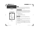
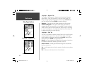
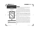
Setup Map — ‘General’ Tab
The ‘General’ Tab contains the settings for Detail, Orientation, Colors, and
Auto Zoom. Below is a description of each feature. To change a setting,
highlight the appropriate fi eld then press ENTER. Make your selection, then
press ENTER to accept the new selection.
Detail —
Settings: Most, More, Normal, Less, and Least. The Detail settings
allow you to control the amount of map data displayed on the unit. If you
select a setting with high detail, the screen redraw times will be slower.
Map Orientation —
Settings: North Up, Track Up, and Course Up. This
options allows you to determine how the map is displayed. If ‘North Up’
is selected, North will always be at the top of the display. If ‘Track Up’ is
selected, your current track will always be toward the top of the display. If
‘Course Up’ is selected, the active course line will always be toward the top
of the display. If you have ‘Course Up’ selected and do not have an active
course, your current track will be toward the top of the display.
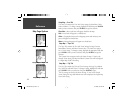
Setup Map — ‘General’ Tab
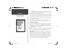
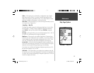
Map Page Options
Reference
190-00249-00_0C.indd 14 5/7/2003, 9:54:38 AM