104 GPSMAP 76CSx Owner’s Manual
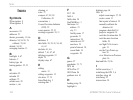
INDEX
INDEX
Symbols
2D navigation 8
3D navigation 8
A
accessories 93
addresses 23
alarms, proxomity 19, 66
altimeter 54, 54–58, 76
calibrate 55, 60
altitude 54–58
averaging location 13
B
backlight 4, 67
batteries 2
battery type 66
bearing pointer 52, 53
C
calculator 83
calendar 82
calibrate 75
calulate area 28
caution i, viii
cleaning vi
color 37
compass 47, 49, 50
Calibration 49
conventions i
Course Deviation Indicator
(CDI) 52
course pointer 52, 53
creating waypoints 10, 11
D
databases 9
data fields 38, 39, 41, 54, 60,
61, 62
declutter 41, 46
default 7, 41, 47, 62
deleting waypoints 12
depth 74
display setup 67
E
editing
routes 33
editing waypoints 12
elevation 37, 74
Enter/Mark key 3
entering data 7
F
FCC 101
field
6
fields, data
54
Find/MOB key 3
find menu 16
address 23
city 21
find by name
17
geocache 21
intersection 24
interstate exit 22
near here 19
point of interest 24
recent finds
18
waypoints 20
G
games 87
geochache 21, 71
GPS 66
GPS off/on
37
GRI Chain 96
guidance text 41
H
heading setup 74
highlight 6
highway page 64
How To
adjust zoom ranges 57, 58
create a route 31
find a point of interest 25
manually calibrate the
altimeter 60
program a data field 61
project a waypoint 14
reset the elevation data 59
reset the max elevation
fields
59
use Sight N Go to navi-
gate 51
use the View Points op-
tion 58
view Elevation or Pressure
plots 56
hunt and fish
19, 86
I
In/Out zoom keys 3
initializing the GPS 5, 6
interface setup 68
interfacing 92
intersections 24


