


30
Reference
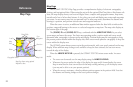
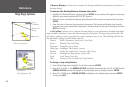
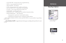
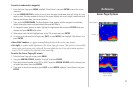
Map Page: Options
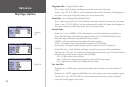
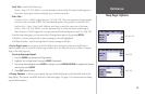
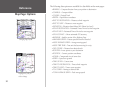
The following data options are available for data fields on the main pages:
• BEARING – Compass direction from your position to destination
• COMPASS – Compass ribbon
• COURSE – Desired Track
• DEPTH – Depth below transducer
• DIST TO DESTINATION – Distance to final waypoint
• DIST TO NEXT – Distance to next waypoint
• ELEVATION – Elevation above/below MSL (Mean Sea Level)
• ETA AT DESTINATION – Estimated Time of Arrival to final waypoint
• ETA AT NEXT – Estimated Time of Arrival to next waypoint
• GPS ACCURACY – Shows estimated GPS accuracy
• HIGHWAY – Smaller version of the Highway Page
• MAXIMUM SPEED – Fastest speed the unit has traveled
• MOVE AVERAGE SPEED – Average moving speed
• MOVE TRIP TIME – Time unit has been moving for a trip
• OFF COURSE – Distance from desired track
• POINTER – Arrow points to your destination
• POSITION – Current position coordinates
• SONAR – Compressed view of sonar data
• SPEED – Speed over ground
• TIME OF DAY – Current time
• TIME TO DESTINATION – Time to final waypoint
• TIME TO NEXT – Time to next waypoint
• TO COURSE – Bearing to desired track
• TOTAL AVERAGE SPEED – Total average speed
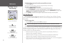
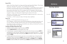
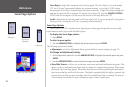
Highlight the field you
wish to change
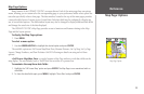
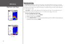
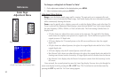
Changing Page Layout