


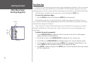
28
Reference
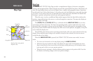
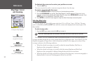
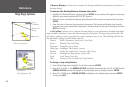
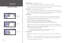
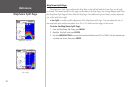
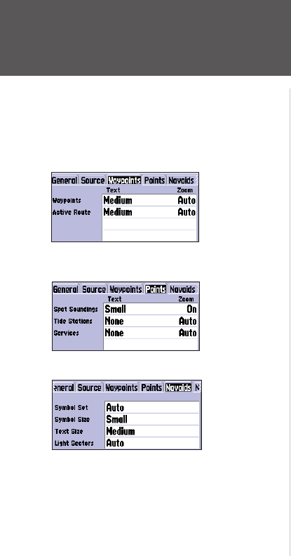
Map Page: Options
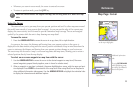
Waypoints Tab— Waypoints/Active Route
Text— None, Small, Medium, and Large: controls the screen size of the name.
Zoom— Auto, Off, 20 ft.-800 mi.: sets the maximum scale at which the feature should appear on
the screen. Some types of data only shows up to certain zoom scales.
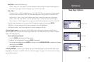
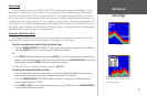
Points Tab
— Spot Soundings/Tide Stations/Services
Text— None (except Spot Snd.), Small, Medium, and Large: controls the screen size of the name.
Zoom— Auto, Off, 20 ft.-800 mi.: sets the maximum scale at which the feature should appear on
the screen. Some types of data only shows up to certain zoom scales.
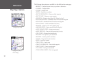
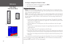
Navaids Tab—
Symbol Set— Auto, GARMIN, NOAA, International: controls the desired navaid symbol set.
Auto -
BlueChart maps are drawn using symbols similar to the NOAA/NIMA standard. Non-
BlueChart maps are drawn using traditional Garmin symbols.
GARMIN - All maps are drawn using traditional Garmin symbols.
NOAA - All maps are drawn using a symbol set similar to NOAA/NIMA.
International - All maps are drawn using a symbol set similar to the IALA symbol set.
Symbol/Text Size— Small, Medium, and Large: controls the screen size of the symbol/name.
Light Sectors— Off, Auto, On: controls the drawing light sectors on the map. Color units indicate
the actual color of each sector using the color of the light.
Off— No light sectors are ever drawn.
Auto— Light sectors appear when you point to them with the map cursor.
On— Light sectors are drawn for all lights that have them.
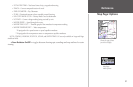
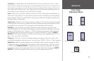
Nav Line Tab—
Heading Line— On/Off: draws an extension from the end of the boat icon in the direction of
travel.
Bearing Line— On/Off: toggles the black/white line which points to the current navigation point.
Course Line— Auto, Off, 20 ft.-800 mi.: sets the maximum zoom scale at which the desired
course line should appear on the screen.
Waypoints
Tab
Points Tab
Navaids Tab