


25
Reference
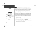
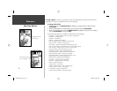
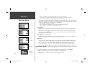
Map Page Options
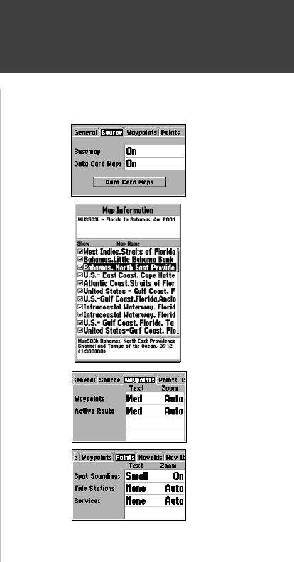
Source Tab
Basemap— On/Off: turns the built in base map on or off.
Data Card Maps— On/Off: turns all optional BlueChart/MapSource data loaded on the data card
on or off. The ‘Data Card Maps’ option box
shows a list of the optional BlueChart/MapSource data
loaded on the data card. Each area is described by name and may be deselected if you do not
wish to display the data on the Map Page.
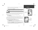
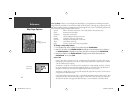
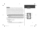
To display the Map Information Page:
1. Highlight the ‘Data Card Maps’ option box and press ENTER/MARK.
2. Use the ARROW KEYPAD to scroll through the list of maps.
3. To select/deselect a map, highlight the check box to the left of the name of the desired map. Press
ENTER/MARK to select/deselect the map. The map is selected and will be displayed on the Map
Page when an “9” appears in the box adjacent to that map. You may also press MENU and
choose to ‘Show All’ or ‘Show None’ and press ENTER/MARK.
4. To display detailed information and notes for each area, highlight the desired name and press
ENTER/MARK. To view the notes for that area, choose ‘Show Notes’. To scroll through the notes,
you may either highlight the notes, press ENTER/MARK and use the ARROW KEYPAD to scroll
UP, DOWN, LEFT and RIGHT or press MENU and choose the desired scroll option.
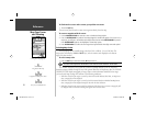
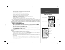
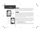
Waypoints Tab— Waypoints/Active Route
Text— None, Small, Medium, and Large: controls the screen size of the name.
Zoom— Auto, Off, 120 ft.-800 mi.: sets the maximum scale at which the feature should appear on
the screen. Some types of data will only show up to certain zoom scales.
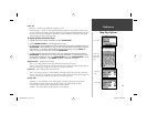
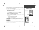
Points Tab
— Spot Soundings/Tide Stations/Services
Text— None (except Spot Snd.), Small, Medium, and Large: controls the screen size of the name.
Zoom— Auto, Off, 120 ft.-800 mi.: sets the maximum scale at which the feature should appear on
the screen. Some types of data will only show up to certain zoom scales.
Navaids Tab—
Symbol Set— Auto, GARMIN, NOAA, International: controls the desired navaid symbol set.
Auto - BlueChart maps are drawn using symbols similar to the NOAA/NIMA standard.
Non-BlueChart maps are drawn using traditional Garmin symbols.
GARMIN - All maps are drawn using traditional Garmin symbols.
Source Tab
Waypoints
Ta b
Points Tab
‘Data Card
Maps’ Map
Information
Page
182C Manual Part 1.indd 25 6/4/2003, 2:52:33 PM