


22
Reference
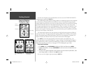
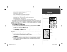
Map Page Options
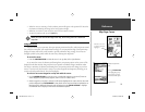
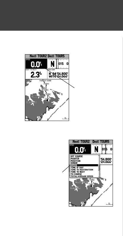
Choose the type of data
you wish to display.
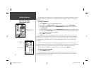
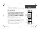
• Change Numbers — allows you to specify the type of data displayed in each data fi eld used on the
map display. This option is available from any of the main pages.
To change a data fi eld:
1. From the menu, use the ARROW KEYPAD to highlight the ‘Change Numbers’ option and press
ENTER/MARK.
2. Move the fi eld highlight to the data fi eld you want to change and press ENTER/MARK.
3. Move up or down on the list using the ARROW KEYPAD to highlight the data you want to display,
and press ENTER/MARK. To exit, press QUIT.
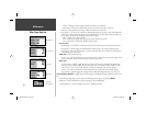
The following data options are available for data fi elds on the main pages:
• BEARING – Compass direction from your position to destination
• COMPASS – Compass ribbon
• COURSE – Desired Track
• DEPTH* – Depth below transducer
• DIST TO DESTINATION – Distance to fi nal waypoint
• DIST TO NEXT – Distance to next waypoint
• ELEVATION – Elevation above/below MSL (Mean Sea Level)
• ETA AT DESTINATION – Estimated Time of Arrival to fi nal waypoint
• ETA AT NEXT – Estimated Time of Arrival to next waypoint
• GPS ACCURACY – Shows estimated GPS accuracy
• HIGHWAY – Smaller version of the Highway Page
• MAXIMUM SPEED – Fastest speed the unit has traveled
• MOVE AVERAGE SPEED – Average moving speed
• MOVE TRIP TIME – Time unit has been moving for a trip
• OFF COURSE – Distance from desired track
• POINTER – Arrow points to your destination
• POSITION – Current position coordinates
• SONAR* – Compressed view of sonar data
• SPEED – Speed over ground
• TIME OF DAY – Current time
• TIME TO DESTINATION – Time to fi nal waypoint
• TIME TO NEXT – Time to next waypoint
• TO COURSE – Bearing to desired track
• TOTAL AVERAGE SPEED – Total average speed
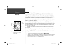
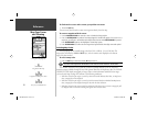
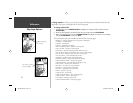
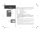
Highlight the fi eld you
wish to change
182C Manual Part 1.indd 22 6/4/2003, 2:52:31 PM