


Garmin aera 795/796 Quick Reference Guide
190-01194-01 Rev. C
23
GPS Navigation
Overview GPS Navigation Flight Planning Hazard Avoidance Utilities Appendix Index
Or:
a)
Touch the buttons to cycle through the waypoint categories
('Flight Plan Waypoints', 'Nearest Airports', or 'Recent
Waypoints').
b)
Touch the desired waypoint from the list.
4)
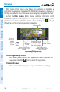
Touch the desired Runway Button. The map range becomes 0.2 nm and
centers on the desired runway. Touch the Runway Button again to return to
the previous map range.
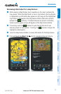
NEAREST INFORMATION
Viewing nearest information:
1)
Touch NRST.
2)
Touch the desired Nearest Icon (Airport, Airport WX, VOR, NDB,
Intersection, VRP, User WPT, City, ARTCC, FSS, or Airspace).
3)
Touch the desired nearest option from the list twice for additional
information.
Or
:
If viewing Nearest ARTCCs or FSSs, touch the buttons to cycle through
the list.
4)
Touch the Back Icon to return to the second level Nearest Icons.
Or
:
Touch Direct To , then the Activate Button to navigate Direct-to the
selected waypoint.
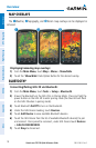
TEXTUAL WEATHER AND NOTAM INFORMATION
Textual weather information can be viewed several different ways. NOTAMs only
available with a GDL 39.
Viewing textual airport weather information:
1)
From the Main Menu, touch the WPT Info Icon.
2)
Enter the desired waypoint:
a)
Touch the buttons to display the desired search option on the 'Search'
Button ('Search by Identifier', 'Search by Facility Name', 'Search by City',
'Search by Address' (only available with the optional City Navigator data), or
'Search by Crossroads' (only available with the optional City Navigator data).