


72 GPSMAP 182/182C Owner’s Manual
MAIN MENU > COMM TAB
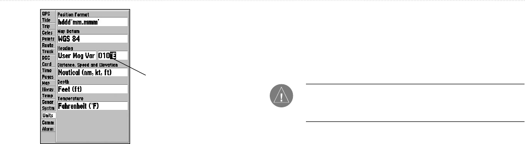
Manually enter a
magnetic variation.
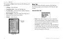
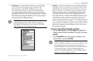
• Distance, Speed and Elevation—select the units of measure
for distance, speed, and elevation readouts in nautical
(nm, kt, m), statute (mi, mh, ft), or metric (km, kh, m) terms.
• Depth—select units of measurement for depth in feet (ft),
fathoms (fa), or meters (m).
• Temperature—select the units of measure for temperature
in Fahrenheit (°F) or Celsius (°C).
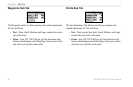
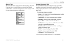
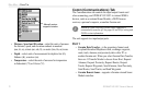
Comm (Communications) Tab
The Communications tab controls the input/output format used
when connecting your GPSMAP 182/182C to external NMEA
devices, such as an external Sonar Module, a DGPS beacon
receiver, a personal computer, or another Garmin unit.
NOTE: If a DGPS receiver is used, WAAS capability is
automatically turned to off. See pages 98 and 99 for wiring and
NMEA version information.
The unit supports two input/output ports.
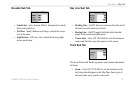
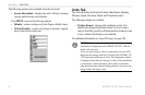
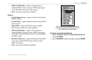
Port 1
• Garmin Data Transfer—is the proprietary format used
to upload/download MapSource data, exchange waypoint,
route, track, almanac, and proximity data with a PC or
another Garmin unit. When you select Garmin Data Transfer,
there are 11 Transfer Modes to choose from: Host, Request
Almanac, Request Proximity, Request Routes, Request
Tracks, Request Waypoints, Send Almanac, Send Proximity,
Send Routes, Send Tracks, and Send Waypoints.
• Garmin Remote Sonar—supports a Garmin external Sonar
Module interface.